Wisconsin Counties
There are seventy-two counties in the state of Wisconsin. Wisconsin became part of the Territory of Michigan and divided into two counties: Brown County in the northeast along Lake Michigan and Crawford County in the southwest along the Mississippi River. The state of Wisconsin was created from Wisconsin Territory on May 29, 1848, with 28 counties.Vilas County, Wisconsin
Vilas County Education, Geography, and History

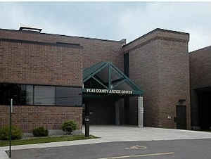
Vilas County is a county in the state of Wisconsin, United States. Based on the 2010 census, the population was 21,430. Its county seat is Eagle River.
Etymology - Origin of Vilas County Name
Named in honor of William F. Vilas of Madison. A native of Vermont (1840), he removed to Wisconsin in 1851, and was graduated from the University of Wisconsin in 1858. During the War of Secession he attained the rank of lieutenant-colonel; was postmaster-general of the United States (1885-88) ; secretary of the interior (1888-91) ; and United States senator (1891-97). He died in August, 1908, leaving to his alma mater the bulk of his large fortune.
[Source: Kellogg, Louise Phelps. "Derivation of County Names" in Proceedings of the State Historical Society of Wisconsin for 1909, pages 219-231.]
Demographics:
County QuickFacts: CensusBureau Quick Facts
Vilas County History
The earliest inhabitants of Vilas County were members of the Chippewa band of Native Americans; the first recorded white settler was a man
named Ashman who established a trading post in Lac du Flambeau in 1818.
In the 1850s migrants from New England, primarily from Vermont and Connecticut, constructed wagon roads and trails through Vilas County
including the Ontonogan Mail Trail and a military road from Fort Howard to Fort Wilkins in Copper Harbor, Michigan.
Before January 1875 it was part of Marathon County; from 1875 to 1885 part of Lincoln County and from 1885-1893, part of Oneida County. Vilas
County was set off from Oneida County on April 12, 1893 and named for William Freeman Vilas. Originally from Vermont, Vilas represented
Wisconsin in the United States Senate from 1891 to 1897
Geography: Land and Water
As reported by the Census Bureau, the county has a total area of 1,018 square miles (2,636 km2), of which, 874
square miles (2,263 km2) of it is land and 144 square miles (373 km2) of it (14.16%) is water. There are 1,318 lakes
in the county.
Neighboring Counties
Bordering counties are as follows:
- Gogebic County, Michigan - north
- Iron County, Michigan - northeast
- Forest County - southeast
- Oneida County - south
- Price County - southwest
- Iron County - west
Education


