


Click Image to Enlarge
Wisconsin Counties
There are seventy-two counties in the state of Wisconsin. Wisconsin became part of the Territory of Michigan and divided into two counties: Brown County in the northeast along Lake Michigan and Crawford County in the southwest along the Mississippi River. The state of Wisconsin was created from Wisconsin Territory on May 29, 1848, with 28 counties.Waushara County, Wisconsin
Waushara County Education, Geography, and History
Waushara County is a county located in the state of Wisconsin. Based on the 2010 census, the population was 24,496. Its county seat is
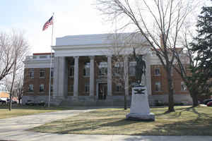
Wautoma.
Waushara County is located in central Wisconsin, about 80 miles (130 km) north of Madison.
Etymology - Origin of Waushara County Name
This name first appeared on the map when the county was erected, and would seem (like Waukesha) to be an attempt of American settlers to apply some little-understood Indian term. One authority considers it equivalent to "good land." Stennett, Place Names, p. 32.
[Source: Kellogg, Louise Phelps. "Derivation of County Names" in Proceedings of the State Historical Society of Wisconsin for 1909, pages 219-231. ]
Demographics:
County QuickFacts: CensusBureau Quick Facts
Waushara County History
Waushara County was established by an act of the Wisconsin Legislature on February 15, 1851. It originally consisted of a single organized Town of Waushara. The county seat was first located at Sacramento and was relocated to Wautoma in 1854 after a bitter fight between proponents of the two places.
John W. Hunt's 1853 Wisconsin Gazetteer
"WAUSHARA, County, is bounded on the north by Portage and Waupacca, east by Winnebago, south by Marquette, and west by Adams, and is 18 miles north and south by 36 miles east and west. It was established February 15, 1851, from Marquette The seat of justice is at Sacramento, in the southeast corner of the county, on Fox river. This county embraces what has been familiarly known recently as the 'Indian Lands" of Marquette county. "
WAUSHARA.--Population 5,541.
From: Handbook of Wisconsin by S. Silas, 1855
pg. 107
In its general features, is similar to Marquette, of which it formed a part till 1851. It is rapidly increasing
in population, having abundance of water power, and the County generally being excellant land and well watered. It
is but a few years since it was known as the "Indian Lands," now receiving a population which will soon develope its
resources. It holds out strong inducements to the immigrant, in the excellent combination of wood, openings, water,
&c.
Wautoma, on the head waters of White River is the County Seat. It has a good water power and machinery is driven by
it, now employed in the manufacture of plows, chairs, &c.
Fox River passes through the south-east corner of the County, on which steamboats run to Berlin in Marquette, which
lies nearly on the line of the two Counties, and is practically a market for Waushara also. The Milwaukee and
Horicon Rail Road is now building to Berlin, and its charter continues it to Stevens Point, through the centre of
the County.
There is abundance of good public land yet to be had. It is partly in the Menasha, but mostly in the Stevens Point
land district.
Geography: Land and Water
As reported by the Census Bureau, the county has a total area of 637 square miles (1,651 km2), of which, 626 square miles (1,621 km2) of it is land and 11 square miles (29 km2) of it (1.78%) is water.
Neighboring Counties
Bordering counties are as follows:
- Portage County - north
- Waupaca County - northeast
- Winnebago County - east
- Green Lake County - south
- Marquette County - south
- Adams County - west
Education


Click Image to Enlarge
