


Click Image to Enlarge
Wisconsin Counties
There are seventy-two counties in the state of Wisconsin. Wisconsin became part of the Territory of Michigan and divided into two counties: Brown County in the northeast along Lake Michigan and Crawford County in the southwest along the Mississippi River. The state of Wisconsin was created from Wisconsin Territory on May 29, 1848, with 28 counties.Wood County, Wisconsin
Wood County Education, Geography, and History
Wood County is a county located in the state of Wisconsin. Based on the 2010 census, the population was 74,749. Its county seat is Wisconsin
Rapids. The county is named after Joseph Wood, a member of the Wisconsin State Assembly.
Wood County comprises the Wisconsin Rapids-Marshfield, WI Micropolitan Statistical Area and is included in the Wausau-Stevens Point-Wisconsin
Rapids, WI Combined Statistical Area.
Etymology - Origin of Wood County Name
Wood County is thus named in honor of Joseph Wood, assemblyman from Grand Rapids when the county was formed. He came to Grand Rapids in 1848, and after serving one term in the legislature (1856), and one as county judge (1857), was mayor of Grand Rapids (1872-75) - Hist. No. Wis., p. 1198.
[Source: Kellogg, Louise Phelps. "Derivation of County Names" in Proceedings of the State Historical Society of Wisconsin for 1909, pages 219-231.]
Demographics:
County QuickFacts: CensusBureau Quick Facts
Wood County History
In the early 19th century the area was settled by early lumber workers harvesting timber along the banks of the
Wisconsin River.
Joseph Wood immigrated to the area from Illinois in 1848 to settle in what was then the city of Grand Rapids (now
Wisconsin Rapids).
Wood County was officially organized in 1856 after Mr. Wood introduced a state legislation bill to create Wood County
from a portion of the existing county of Portage to the east.
Mr. Wood served one term in the state legislature, one year as a county judge, was a multi-term County Board Supervisor,
and served as postmaster and mayor of Grand Rapids.
Wood County is located in the geographic center of the state of Wisconsin. This location makes everything in
Wisconsin within a driving range of, usually, no more than 4 hours.
Major Wood County municipalities are the City of Marshfield (home to the renowned Marshfield Clinic), as well as the
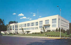
cities of Nekoosa and Pittsville. The county seat is located in the County Courthouse at 400 Market Street Wisconsin
Rapids, WI 54494.
With a population base of approximately 75,000 people Wood County is a prime location for industry and shipping
within the state. Current major industries are in paper production
Geography: Land and Water
As reported by the Census Bureau, the county has a total area of 809 square miles (2,096 km2), of which, 793
square miles (2,053 km2) of it is land and 17 square miles (43 km2) of it (2.06%) is water.
Neighboring Counties
Bordering counties are as follows:
- Marathon County - north
- Portage County - east
- Adams County - southeast
- Juneau County - south
- Jackson County - southwest
- Clark County - northwest
Education


Click Image to Enlarge
