


Delaware Geography: The Land
Geography and Landforms of Delaware
Find an overview of Delaware geography, topography, geographic land regions, land areas, and major rivers.
Access Delaware almanac, furnishing more details on the state geography, geographical and land regions, climate and weather, elevation, land areas, bordering states, and other statistical data.
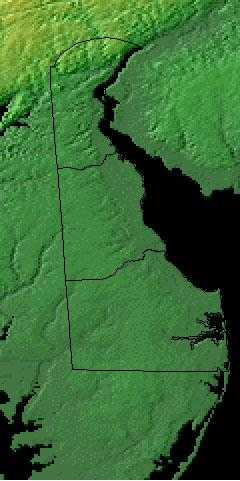
The state of Delaware consists of two major land regions: The Piedmont and the Atlantic Coastal Plain.
Delaware is our second smallest state. It is only 96 miles long and ranges from 9 to 35 miles in width.
Together with Eastern Shore Maryland and Virginia, Delaware occupies the Delmarva peninsula. It lies on the northeast of the peninsula, facing the Delaware River, which broadens into Delaware Bay; the bay in turn joins the Atlantic Ocean at Cape Henlopen. Delaware is sometimes called the Diamond State, a reference to its small size but relative wealth. With the Delaware River and Bay along its entire eastern edge, no place in the narrow state is far from water.
Delaware Highest, Lowest, & Mean Elevations |
|
|---|---|
| Mean Elevation | 60 ft. |
| Highest Point | Ebright Road, Del.-Pa. state line New Castle County 448 ft. |
| Lowest Point | Atlantic Ocean Sea level |
Delaware Land Area (Square Miles) |
|
| Geographic Center | In Kent County, 11 miles south of Dover Longitude: 75?#8218;° 30.7'W Latitude: 38?#8218;° 58.8'N |
| Total Area | 2,489.27 sq. mi. 49th |
| Land Area | 1,953.56 sq. mi. 78.51% |
| Water Area | 535.71 sq. mi. 21.49% |
| Forested Land Area | 31.1% |
| Dimensions (Length - Width) |
100 miles - 30 miles |
Delaware: Physiographic Regions
The State of Delaware is located within two physiographic provinces:
- the Appalachian Piedmont and the
- Atlantic Coastal Plain.
Most of the state lies within the Coastal Plain; it is only the hills of northern New Castle County that lie within the Piedmont. Piedmont means foothills. Delaware's rolling hills, which rise to over 400 feet above sea level, are a part of the foothills of the Appalachian Mountains.
The Appalachian Piedmont
The Piedmont Physiographic Region of Delaware only includes the hills of northern New Castle County, which rise to approximately 400 feet above
sea level. The Piedmont extends into neighboring Pennsylvania and Maryland.
The rocks exposed in the Piedmont are metamorphic and igneous rocks that are approximately half a billion to 1.2 billion years old. The only Precambrian
rock unit is the Baltimore Gneiss. Cambrian to Ordovician rocks include Wilmington Complex, Setters Formation, Cockeysville Marble, and Wissahickon
Formation. Silurian rocks include the Iron Hill Gabbro, Bringhurst Gabbro, and Arden Plutonic Supersuite The cities of Wilmington and Newark lie at
the Fall line, where the northern margin of the younger Cretaceous coastal plain sediments overlie the older Piedmont rocks.
An area of gently rolling hills found in the northwest corner of the state, is 10 miles wide at its widest point. The highest point in Delaware, just 450 feet above sea level, is found in the Piedmont.
Atlantic Coastal Plain
The coastal plain in Delaware is by far the largest province, encompassing all of the state south of the Kirkwood Highway from Newark to Wilmington. The unconsolidated sediments of the coastal plain range in age from Cretaceous to recent. They consist of gravels, sands, silt, and clay, with varying mixtures of all four. The oldest layer, the Potomac Formation also contains some scattered lignite.
The Atlantic Coastal Plain stretches across the rest of the state, a low, flat region that rises only about 80 feet above sea level. A 30,000-acre swamp lies along southern boundary of the state. A long sand bar - 28 miles long - forms a border with the Atlantic Ocean. This sandy strip to the east is a popular vacation region.
As recently as five million years ago, much of present-day Delaware was submerged as the floor of a shallow sea, the Salisbury Embayment; only with the retreat of global sea levels in recent geologic times did the coastal plain areas of the state emerge as dry land.
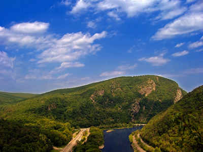
Delaware River Basin Landscape and Landforms:
Parts of five physiographic provinces lie within the Delaware River Basin. These are the Coastal Plain, Piedmont, New England, Valley and Ridge, and Appalachian Plateaus. Topography varies from the relatively flat Coastal Plain, which consists of unconsolidated sediments, to rolling lowlands and a series of broad uplands in the Piedmont. North of the Piedmont Province, the New England and the Valley and Ridge Provinces consist of rock layers that have been deformed into a series of steep ridges and parallel folds that trend northeast-southwest. The Appalachian Plateaus occupy the upper one-third of the basin and are characterized by rugged hills with intricately dissected plateaus and broad ridges. Altitude in the basin increases from sea level in the south to more than 4,000 feet in the north. During the last major glacial advance, the Appalachian Plateaus and parts of the Valley and Ridge and the New England Provinces were glaciated. North of the line of glaciation, valleys typically are underlain by thick layers of stratified drift and till.
Mid-Atlantic Coastal Plain
The Mid-Atlantic Coastal Plain extends from the Atlantic Ocean, south of Long Island, to the Fall Line, where the hilly Piedmont begins. It is arbitrarily separated from the South Atlantic Coastal Plain at the Virginia-North Carolina border (with the exception of the Great Dismal Swamp in the southeast corner of Virginia, which is grouped in the southern area). The area was formed by shifting sea levels and alluvial deposition from rivers draining mountains to the west. Water continues to be a dominant feature of the landscape, creating forested wetlands and salt marsh and shaping barrier island and bay complexes. Upland forests on the remaining land graded in composition from pine dominated areas on the outer Coastal Plain (nearer the coast) to hardwood forests on the inner Coastal Plain. This was the site of the first successful English settlement in North America, and the natural landscape has been altered by European culture for nearly four centuries. The current human population approaches 11 million and is expected to continue to expand into the future, placing ever-increasing demands on the region's natural resources.
Northern Ridge and Valley
The Northern Ridge and Valley extends from southeastern Pennsylvania, through northwestern New Jersey and southeastern New York nearly to the base of the Adirondack Mts. It includes portions of several major river valleys, including the Hudson, Delaware, and Susquehanna Rivers. Ecologically, this is a transitional area, with forested ridges grading from primarily oak-hickory forests in the south to northern hardwood forests further north. Pine-oak woodlands and barrens and hemlock ravine forests are also important along ridges, whereas bottomland and riparian forests are important in the valleys, which are now largely cleared for agricultural and urban development. Roughly 50% of the physiographic area is forested today, the vast majority occurring at higher elevations. About 40% of the area is in agricultural production, primarily a mixture of dairy pastureland and corn. Over 200,000 ha is state forest land in PA and NJ; other important public lands include High Point State Park (NJ) and Wallkill National Wildlife Refuge.

