


Delaware State Almanac: Facts and Figures
Quick Facts, Figures, and Overview of the State of Delaware
Delaware is one of the South Atlantic states of the US. The state is surrounded by Pennsylvania on its northern border, by New Jersey and the Atlantic Ocean on its eastern border and by Maryland on its western and southern border. The Indians and the state of Delaware were both named after the Delaware River. And where did the river get it's name? The Delaware River was named after Sir Thomas West (Lord de la Warr)
In 1802, Eleuthere Irenee du Pont established a gunpowder mill near Wilmington that laid the foundation for Delaware's huge chemical industry. Delaware's manufactured products now also include vulcanized fiber, textiles, paper, medical supplies, metal products, machinery, machine tools, and automobiles. In the early 2000s, Delaware's economy was dominated by financial services and manufacturing; the state was noted as the home of the huge E. I. du Pont de Nemours & Co. chemical firm.
Delaware also grows a great variety of fruits and vegetables and is a US pioneer in the food-canning industry. Corn, soybeans, potatoes, and hay are important crops. Delaware's broiler-chicken farms supply the big Eastern markets, and fishing and dairy products are other important industries.
Delaware Almanac: Facts on the State of Delaware |
|
|---|---|
| Official Name | Delaware |
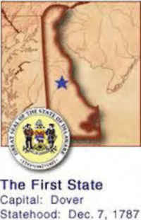
| Capital | Dover |
| Nicknames | First State (Official) ...and more |
| Motto | Liberty and independence |
| Location Region |
39.15869 N, 075.51744 W Middle Atlantic Northeastern |
| Constitution Ratified | 1897 |
| Statehood | December 07, 1787 1st State |
| Population | 897,934 (2010) 400.82 sq. mi. 45th |
| Largest City (by population) |
10 largest cities (2010): Wilmington, 70,851; Dover, 36,047; Newark, 31,454; Middletown, 18,871; Smyrna, 10,023; Milford, 9,559; Seaford, 6,928; Georgetown, 6,422; Elsmere, 6,131; New Castle, 5,285 |
| Bordering States | North: Pennsylvania East: Delaware River, Delaware Bay, and the Atlantic Ocean South and West: Maryland Coastline: 28 mi. |
| Major Industry | business, agriculture and tourism |
| Major Rivers | Delaware River, Mispillion River, Nanticoke Rive |
| Major Lakes | none |
| Delaware Counties | 3 counties in Delaware |
| Largest County (by population) |
New Castle County 538,479 (2010) 426 sq. mi. |
| Largest County (by area) |
Sussex County 938 sq. mi. |
| State forests | 3 (over 15,000 ac.) |
| State parks | 14 (over 20,000 ac.) |
| Electoral Votes | 3 |
| US Congress | 2 Senators; 1 Representative |
| Time Zone | Eastern Standard Time |
| Zip Codes | NANPA |
| State Quick Facts | Census Bureau Quick Facts |
Delaware Climate and Weather |
|
|---|---|
| Delaware's climate is moderate year round. Average monthly temperatures range from 75.8 to 32.0 degrees. Average temperature in the summer months is 74.3 degrees. About 57% of the days are sunny. Annual precipitation is approximately 45 inches. Temperatures along the Atlantic Coast are about 10 degrees warmer in winter and 10 degrees cooler in summer. The average growing season varies from 170 to 200 days. | |
| Highest Temperature | 110 degrees July 21, 1930 - Millsboro |
| Lowest Temperature | -17 degrees January 17, 1893 - Millsboro |
| Avg. Temp: High - Low |
85.6 degrees 23.2 degrees |
Delaware Points of Interest |
|
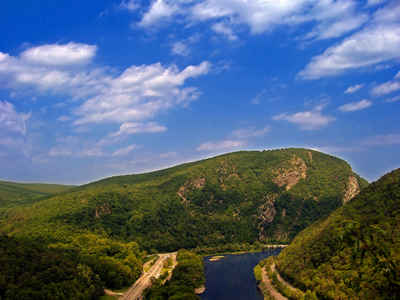
| Delaware offers a wide variety of attractions, including the Delaware Canal historic areas, Delaware Bay and seashore, Fort Delaware, Fort Christina Monument, Hagley Museum, Holy Trinity Church (erected in 1698, the oldest Protestant church in the United States still in use), Winterthur Museum, and Dover and Wilmington cultural attractions...to name but a few. | |
Delaware Highest, Lowest, and Mean Elevations (Feet) |
|
| Mean Elevation: 60 feet | |
|
Highest Point: Ebright Azimuth; Ebright Road, Del.-Pa. state line; New Castle County:
|
|
| Lowest Point: | Atlantic Ocean Sea level |
Delaware Land Area (Square Miles) |
|
| Geographic Center | In Kent County, 11 miles south of Dover Longitude: 75°30.7'W Latitude: 38°58.8'N |
| Total Area | 2,489.27 sq. mi. 49th |
| Land Area | 1,953.56 sq. mi. 78.51% |
| Water Area | 535.71 sq. mi. 21.49% |
| Forested Land Area | 31.1% |
| Dimensions (Length - Width) |
100 miles - 30 miles |
 The
highest benchmark monument in Delaware is located on Ebright Road. This horizontal control mark denotes an elevation of 447.85 feet above sea level.
The Delaware Geological Survey through its relationship with the National Geodetic Survey has determined that this benchmark monument is in the vicinity
of the highest natural elevation in the state.
The
highest benchmark monument in Delaware is located on Ebright Road. This horizontal control mark denotes an elevation of 447.85 feet above sea level.
The Delaware Geological Survey through its relationship with the National Geodetic Survey has determined that this benchmark monument is in the vicinity
of the highest natural elevation in the state.
