


New Mexico Geography: The Land
Geography and Landforms of New Mexico
 Find an overview of New Mexico
geography, topography, geographic land regions, land areas, and major rivers.
Find an overview of New Mexico
geography, topography, geographic land regions, land areas, and major rivers.
Access New Mexico almanac furnishing more details on the state geography, geographical and land regions, climate and weather, elevation, land areas, bordering states, and other statistical data.
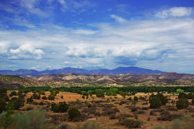
New Mexico has some of the flattest land as well as some of the most rugged mountains in the country. Some portions of the state are rich in pine forests, meadows, and fish-laden mountain streams, while other areas are devoid of any water bodies, and even cacti struggle to survive.
New Mexico Highest, Lowest, & Mean Elevations |
|
|---|---|
| Mean Elevation | 5,700 ft. |
| Highest Point | Wheeler Peak 13,161 ft. |
| Lowest Point | Red Bluff Reservoir 2,842 ft. |
New Mexico Land Area (Square Miles) |
|
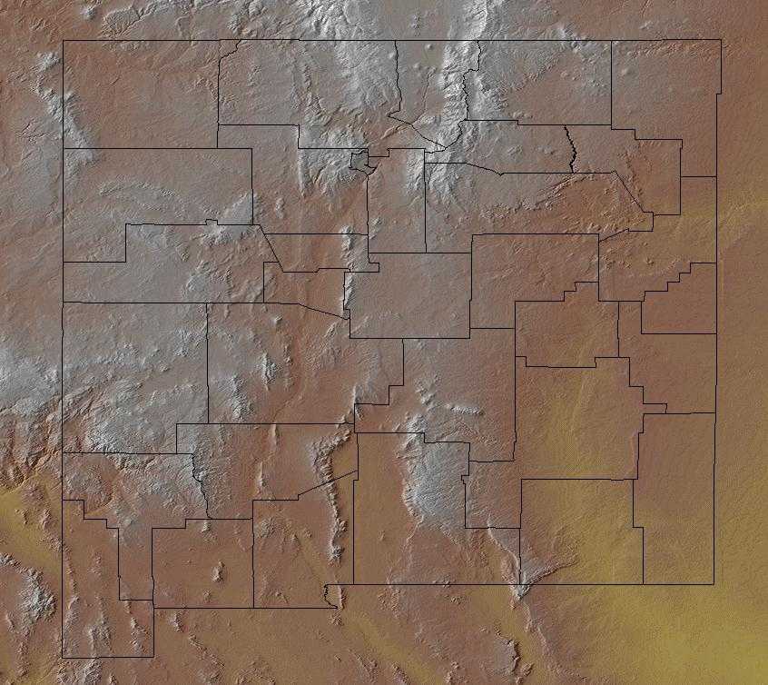
| Geographic Center | In Torrance County, 12 mi. SSW of Willard Longitude: 106° 6.7'W Latitude: 34° 30.1'N |
| Total Area | 121,589.48 sq. mi. 5th |
| Land Area | 121,355.53 sq. mi. 99.81% |
| Water Area | 233.96 sq. mi. 0.19% |
| Forested Land Area | 20% |
| Dimensions (Length - Width) |
370 miles - 343 miles |
New Mexico: Physiographic Regions
The landscape of New Mexico comprises four land regions:
- Great Plains
- High Plains
- Rocky Mountains
- The Basin and Range Region
Great Plains
The Great Plains cover the eastern third of the state. This region consists of a high plateau intersected by deep canyons. This area is use for sheep and cattle ranches. To the south, dry farming and irrigated agriculture is possible. South of the Canadian River, along the eastern edge of New Mexico, the land is referred to as the High Plains or Staked Plains (Llano Estacado). These High Plains run along the Texas border in New Mexico.
High Plains
The area along the eastern edge of the state, south of the Canadian River is known as the High Plains. The region is also known as the Staked Plains.
Rocky Mountains
Located in the central part of New Mexico, the Rocky Mountains extend into New Mexico from Colorado to the north. The Rio Grande River cuts through the Rocky Mountains from north to south. The Sangre de Cristo (Blood of Christ) Mountain range, east of the Rio Grane .Wheeler Peak, the highest point in New Mexico is found in this range. To the west of the Rio Grande are the Nacimiento and Jemez Mountain ranges. The fertile Rio Grande Valley provides suitable farm land using modern irrigation techniques.
Central Colorado makes up the bulk of the Southern Rockies, which extend into northern New Mexico and southern Wyoming. Steep, rugged mountains cover this region, and vegetation varies greatly on the basis of elevation and aspect. Alpine tundra gives way to various coniferous forests often with aspen intermixed. Ponderosa pine is at lower elevations, pinyon-juniper below that, and grasslands in the lowest areas. Because of topography, weather, avalanches, fire, insect outbreaks, and disease, forests in the Southern Rocky Mountains tend to be patchier than in many other areas. The landscape is thus a complex mosaic of open meadows and forest stands of varying age and species composition.
Basin and Range Region
The Basin and Range region is found to the southwest and covers nearly one third of New Mexico. It consists of scattered mountain ranges intersected by desert basins. The Rio Grande River flows through the region and is harnessed by the Elephant Butte Dam which provides a major source of irrigation for farming.
New Mexico Landscape and Landforms:
Chihuahuan Desert
In the United States, the Chihuahuan Desert includes the Trans-Pecos of Texas, southern New Mexico, and a small area in southeast Arizona. Broad basins and valleys bordered by sloping alluvial fans and terraces make up the dry lowlands of this region, punctuated by occasional mesas and mountain ranges. The Rio Grande and Pecos are the primary rivers of the Chihuahuan Desert. In this arid region, riparian corridors provide important habitat for breeding, in-transit, and wintering birds. Other drainages end in closed basins and include few permanent streams. Arid grass and shrubland are the primary lowland vegetation types, often dominated by creosote. This grades uphill into oak-juniper woodlands and even coniferous forest in the highest reaches. The Madrean mountains mark its western edge, the Edwards Plateau its east, and the reduced shrubbiness of the shortgrass plains its north. The Chihuahuan Desert extends south across much of the Central Plateau of Mexico, bordered by the Sierra Madre Occidental and Oriental.
Colorado Plateau
The Colorado Plateau is centered on the four corners area and extends into Colorado, Utah, Arizona, and New Mexico. It is an area of tablelands with moderate to high relief dissected by narrow and widely-spaced stream valleys. The Colorado Plateau is characterized by limited precipitation, cold winters and hot summers. Lowest elevations are covered with arid shrublands with grass interspersed. Sagebrush is dominant over large areas, with cottonwoods along perennial water courses. At moderate elevations, woodland vegetation is dominated by pinyon pine and juniper, with various shrubs intermixed. Montane forest is in high elevations, with ponderosa pine and Douglas fir dominant to the south and lodgepole pine and aspen farther north.
Mesa and Plains
This physiographic area is located almost entirely in central New Mexico. Major landforms are valleys, lowlands, outwash plains, and alluvial fans
and terraces. The middle reach of the Rio Grande is found here. Grama and galleta grasses and four-wing saltbush occur along with sand sage at lower
elevations, pinyon-juniper at higher elevations, and conifers are in the scattered mountain ranges. Riparian strips along water courses have cottonwood-willow
and non-native salt cedar.
Mexican Highlands
The isolated mountain ranges of southeastern Arizona and southwestern New Mexico represent the northern terminus of the Sierra Madre Occidental. Elevation determines vegetation, with Douglas fir and pine at higher elevations giving way to oak-dominated forest at lower elevations. Lowlands surrounding the ranges are desert grasslands similar to the Sonoran Desert on the west and Chihuahuan desert on the east.
Mogollon Rim
The Mogollon Rim is primarily in Arizona, extending somewhat into southwest New Mexico. Lower elevations and latitude differentiate this highland from other mountains to the north and east. Open ponderosa pine forests dominate much of the area, with oak woodlands, pinyon-juniper, and chaparral at lower elevations.
Pecos and Staked Plains
The Staked and Pecos Plains cover the western panhandle of Texas, the west end of the panhandle of Oklahoma, and extensive areas in eastern New Mexico. These high and dry plains are covered with a shortgrass prairie dominated by grama and buffalo grasses. There are also extensive areas of shinnery, a midgrass prairie with low shrubs. The area grades into taller grass to the east, to Trans-Pecos shrub savannah to the south, and more chaparral and pinyon-juniper in the Mesas and Plains area to the west. The northern border of Oklahoma is established as an arbitrary northern limit.

