New Mexico State Almanac: Facts and Figures
Quick Facts, Figures, and Overview of the State of New Mexico

New Mexico is one of the Mountain states of the US. New Mexico is one of the Four Corners states, meeting the boundaries of Colorado, Arizona, and Utah at one point where all their corners meet. Name of New Mexico is an anglicized version of "Nuevo Mexico," the Spanish name for the upper Rio Grande. Mexico, an Aztec spelling, means "place of Mexitli" one of the Aztec gods.
Since 1945, New Mexico has been a leader in energy research and development with extensive experiments conducted at Los Alamos Scientific Laboratory and Sandia Laboratories in the nuclear, solar, and geothermal areas. Minerals are the state's richest natural resource, and New Mexico is one of the U.S. leaders in output of uranium and potassium salts. Petroleum, natural gas, copper, gold, silver, zinc, lead, and molybdenum also contribute heavily to the state's income. The principal manufacturing industries include food products, chemicals, transportation equipment, lumber, electrical machinery, and stone-clay-glass products. About two-thirds of New Mexico's farm income comes from livestock products, especially dairy and cattle. Pecans, hay, and onions are the most important field crops. Corn, peanuts, beans, onions, chilies, and lettuce are also grown.
New Mexico Almanac: Facts on New Mexico |
|||
|---|---|---|---|
| Official Name | New Mexico | ||
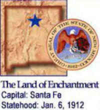
| Capital | Santa Fe | ||
| Nicknames | Land of Enchantment (1999) ...and more | ||
| Motto | Crescit Eundo (It grows as it goes) | ||
| Location Region |
35.67850 N, 105.95414 W Great Plains Rocky Mountains Southwestern |
||
| Constitution Ratified | 1911 | ||
| Statehood | January 06, 1912 47th state |
||
| Population | 2,059,179 (2010) 14.99 sq. mi. 36th |
||
| Largest City (by population) |
10 largest cities (2010 est.):Albuquerque, 545,852; Las Cruces, 97,618; Santa Fe, 70,631; Rio Rancho, 67,947; Roswell, 48,366; Farmington, 45,877; Clovis, 37,775; Hobbs, 34,122; Alamogordo, 30,403; Carlsbad, 26,138 | ||
| Bordering States | North: Colorado East: Oklahoma and Texas South: Texas and the Mexican state of Chihuahua West: Arizona |
||
| Major Industry | mining (potash, copper, silver, uranium), oil, natural gas, tourism | ||
| Major Rivers | Rio Grande, Pecos River | ||
| Major Lakes | Elephant Butte Reservoir, Conchas Lake, Navajo Reservoir | ||
| New Mexico Counties | 33 Counties in New Mexico | ||
| Largest County (by population) |
Bernalillo County 662,564 (2010) 1,166 sq. mi. |
||
| Largest County (by area) |
Catron County 6,928 sq mi |
||
| State parks | 31 | ||
| Electoral Votes | 5 | ||
| US Congress | 2 Senators; 3 Representatives | ||
| Time Zone | Mountain Standard Time | ||
| Zip Codes | NANPA | ||
| State Quick Facts | Census Bureau Quick Facts | ||
New Mexico Climate and Weather |
||
|---|---|---|
| New Mexico has considerable variation in climate, particularly from lower to higher elevations. Overall, it's got lots of sunshine and low humidity. Summer is hot, with temperatures in low elevations sometimes reaching the 100s F/38+ C. The average July high temperature, though, is in the low 90s F/32-35 C at lower elevations and the high 70s F/23-25 C at higher spots. July and August have the most rain, often in brief but intense thunderstorms, which moderate the summer heat. Nights cool off quickly to the comfortable mid 60s F/15-17 C (mid 50s F/10-13 C in the mountains). Winters are moderately cold, especially in the mountains, where the average January high is in the mid 30s F/2-4 C (mid 50s F/10-12 C elsewhere). The higher elevations are the skier's playground - some places in the northern mountains claim 100 in/254 cm of snow annually - but the snow isn't heavy everywhere, and what falls may not last. | ||
| Highest Temperature | 122 degrees June 27, 1994 - Lakewood |
|
| Lowest Temperature | -50 degrees February 1, 1951 - Gavilan |
|
| Avg. Temp: High - Low |
92.8 degrees | 22.3 degrees |
New Mexico Points of Interest |
||
| Carlsbad Caverns, Chaco Canyon, the International UFO Museum in Roswell, Indian cliff dwellings, Sandia Peak Tramway, Santa Fe, Taos, Carlsbad Caverns National Park, Inscription Rock at El Morro National Monument, the ruins at Fort Union, Billy the Kid mementos at Lincoln, the White Sands and Gila Cliff Dwellings National Monuments, Bandelier National Monument, and the Chaco Culture National Historical Park, and a wide assortment of monuments, and of course, New Mexico's dazzling scenery. | ||
New Mexico Highest, Lowest, and Mean Elevations (Feet) |
||
| Mean Elevation: 5,700 feet | ||
|
Highest Point: Wheeler Peak: 13,161 feet
|
||
| Lowest Point: | Red Bluff Reservoir 2,842 feet |
|
New Mexico Land Area (Square Miles) |
||
| Geographic Center | In Torrance County, 12 mi. SSW of Willard Longitude: 106°6.7'W Latitude: 34°30.1'N |
|
| Total Area | 121,589.48 sq. mi 5th |
|
| Land Area | 121,355.539 sq. mi 9.81% |
|
| Water Area | 233.96 sq. mi 0.19% |
|
| Forested Land Area | 20% | |
| Dimensions (Length - Width) |
370 miles - 343 miles | |
| Source:(US Census, April 1, 2000) |
||


 The Wheeler Peak Wilderness includes
almost 20,000 acres. Lying along the top of the Sangre De Cristo mountain range Wheeler Peak Wilderness is characterized by high rugged terrain.
Elevations range from a low of 7,650 feet to a high of 13,161 feet at Wheeler Peak, the highest point in the State of New Mexico.