


Click Image to Enlarge
Idaho Counties
There are forty-four Counties in Idaho. When Idaho became a territory in March, 1863, there were four Counties in existence: Boise, Idaho, Nez Perce and Shoshone. By the time Idaho became a state, there were 15 counties. The rest of the 44 Counties came into existence during the 30 years after Idaho became a state. Two of the former counties disappeared during this time. Alturas, which was created in 1864, was later divided into the many counties now found in central Idaho. Logan County was only in existence for six years, from 1889 to 1895. It was combined with Alturas to form Blaine County and Lincoln County, which was formed just two weeks after Logan lost its identity.Ada County, Idaho
Ada County Education, Geography, and History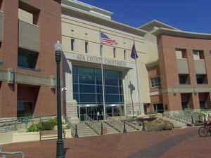
Ada County is a county in the southwestern part of the state of Idaho. Based on the 2010 census, the county had a
population of 392,365,
making it the most populous county in Idaho. Ada County was
created on December 22, 1864. The county
seat and largest city is Boise, which is also the state capital.
The county is named in honor of Ada Riggs, daughter of
H. C. Riggs, a member of the Idaho Territorial Legislature.
Ada County is included in the Boise, ID Metropolitan Statistical Area.
Etymology - Origin of Ada County Name
Ada County is named for Ada Riggs, the first pioneer child born in the area and the daughter of H. C. Riggs, a cofounder of Boise.
Demographics:
County QuickFacts: CensusBureau Quick Facts
Ada County History
Established December 22, 1864 with its county seat at Boise. Named for Ada Riggs, the first white child born in the area and the daughter of H.C. Riggs, one of the founders of Boise and a member of the Idaho Territorial Legislature. Boise became the capital of Idaho in 1865
Geography: Land and Water
As reported by the Census Bureau, the county has a total area of 1,060 square miles (2,700 km2), of which 1,053 square miles (2,730 km2) is land and 7.9 square miles (20 km2) (0.7%) is water.
Ada county is located close to the center of Idaho. The Boise River flows through the northern portion of the county, and the northwest border is bounded by the foothills of the Boise Range mountains, the summits are in adjacent Boise County. The southwestern border of the county is bounded by the Snake River.
Neighboring Counties
Bordering counties are as follows:
- North: Gem County
- Northeast: Boise County
- East: Elmore County
- South: Owyhee County
- Northwest: Canyon County
Education
Public school districts
- Boise School District
- West Ada School District
- Kuna School District


Click Image to Enlarge
