


Click Image to Enlarge
Idaho Counties
There are forty-four Counties in Idaho. When Idaho became a territory in March, 1863, there were four Counties in existence: Boise, Idaho, Nez Perce and Shoshone. By the time Idaho became a state, there were 15 counties. The rest of the 44 Counties came into existence during the 30 years after Idaho became a state. Two of the former counties disappeared during this time. Alturas, which was created in 1864, was later divided into the many counties now found in central Idaho. Logan County was only in existence for six years, from 1889 to 1895. It was combined with Alturas to form Blaine County and Lincoln County, which was formed just two weeks after Logan lost its identity.Idaho Counties: History and Information
Find a brief history of Idaho Counties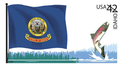
The State of Idaho is a state in the Pacific Northwest region of the United States of America. The state's largest city and capital is Boise. Residents are called "Idahoans." Idaho was admitted to the Union on 3 July 1890 as the 43rd state.
Humans may have been present in the Idaho area as long as 14,500 years ago. Excavations at Wilson Butte Cave near Twin Falls in 1959 revealed evidence of human activity, including arrowheads, that rank among the oldest dated artifacts in North America. Native American tribes predominant in the area included the Nez Perce in the north and the Northern and Western Shoshone in the south.
Idaho, as part of the Oregon Country, was claimed by both the United States and Great Britain until the United States gained undisputed jurisdiction in 1846. Between then and the creation of the Idaho Territory in 1863, parts of the present-day state were included in the Oregon, Washington, and Dakota Territories. The new territory included most of present-day Idaho, Montana, and Wyoming. The first organized communities, within the present borders of Idaho, were established in 1860.
When the Idaho Territory was created in March 1863, there were five original counties: Shoshone, Nez Perce, Idaho, Boise, and Missoula. Kootenai, Owyhee, and Oneida were created by 1865, Ada was created in 1866, and when the territory reached Idaho's present day dimensions in 1868, Lemhi was formed. By 1880, 13 counties were created. Ten years later, when Idaho became a state, 18 counties were created. In 1893, Fremont and Bannock counties were created. By 1900, Idaho had 21 counties. Ten years later, only two new counties were created. Between 1910 and 1920, 21 new counties were created, bringing the number of counties to 44, where it remains today.
After some tribulation as a territory, including the chaotic transfer of the territorial capital from Lewiston to Boise, disenfranchisement of the
large Mormon minority and a federal attempt to split the territory between Washington Territory and the state of Nevada, Idaho achieved statehood in
1890. The economy of the state, which had been primarily supported by metal mining, shifted towards agriculture and tourism.
Defunct Idaho counties
- Alturas County: A huge south-central Idaho county formed in 1864. Abolished in 1895.
- Lah-Toh County: North Idaho county formed in 1864. Abolished in 1867.
- Logan County: Formed by an 1889 partition of Alturas County. Abolished in 1895.
| Find a brief history of Idaho Counties | ||||
|---|---|---|---|---|
| County | 2000 Population |
Square Miles |
County Seat | Created |
| Ada County | 300,904 | 1,055 | Boise | 1864 |
| Adams County | 3,476 | 1,365 | Council | 1911 |
| Bannock County | 75,565 | 1,113 | Pocatello | 1893 |
| Bear Lake County | 6,411 | 971 | Paris | 1893 |
| Benewah County | 9,171 | 776 | Saint Maries | 1915 |
| Bingham County | 41,735 | 2,095 | Blackfoot | 1885 |
| Blaine County | 18,991 | 2,645 | Hailey | 1895 |
| Boise County | 6,670 | 1,902 | Idaho City | 1907 |
| Bonner County | 36,835 | 1,738 | Sandpoint | 1907 |
| Bonneville County | 82,522 | 1,869 | Idaho Falls | 1911 |
| Boundary County | 9,871 | 1,269 | Bonners Ferry | 1915 |
| Butte County | 2,899 | 2,233 | Arco | 1917 |
| Camas County | 991 | 1,075 | Fairfield | 1917 |
| Canyon County | 131,441 | 590 | Caldwell | 1892 |
| Caribou County | 7,304 | 1,766 | Soda Springs | 1919 |
| Cassia County | 21,416 | 2,567 | Burley | 1879 |
| Clark County | 1,022 | 1,765 | Dubois | 1919 |
| Clearwater County | 8,930 | 2,462 | Orofino | 1911 |
| Custer County | 4,342 | 4,926 | Challis | 1881 |
| Elmore County | 29,130 | 3,078 | Mountain Home | 1889 |
| Franklin County | 11,329 | 666 | Preston | 1913 |
| Fremont County | 11,819 | 1,867 | Saint Anthony | 1893 |
| Gem County | 15,181 | 563 | Emmett | 1915 |
| Gooding County | 14,155 | 731 | Gooding | 1913 |
| Idaho County | 15,511 | 8,485 | Grangeville | 1864 |
| Jefferson County | 19,155 | 1,095 | Rigby | 1913 |
| Jerome County | 18,342 | 600 | Jerome | 1919 |
| Kootenai County | 108,685 | 1,245 | Coeur d Alene | 1864 |
| Latah County | 34,935 | 1,077 | Moscow | 1888 |
| Lemhi County | 7,806 | 4,564 | Salmon | 1869 |
| Lewis County | 3,747 | 479 | Nezperce | 1911 |
| Lincoln County | 4,044 | 1,206 | Shoshone | 1895 |
| Madison County | 27,467 | 472 | Rexburg | 1913 |
| Minidoka County | 20,174 | 760 | Rupert | 1913 |
| Nez Perce County | 37,410 | 849 | Lewiston | 1864 |
| Oneida County | 4,125 | 1,200 | Malad City | 1864 |
| Owyhee County | 10,644 | 7,678 | Murphy | 1863 |
| Payette County | 20,578 | 408 | Payette | 1917 |
| Power County | 7,538 | 1,406 | American Falls | 1913 |
| Shoshone County | 13,771 | 2,634 | Wallace | 1864 |
| Teton County | 5,999 | 450 | Driggs | 1915 |
| Twin Falls County | 64,284 | 1,925 | Twin Falls | 1907 |
| Valley County | 7,651 | 3,678 | Cascade | 1917 |
| Washington County | 9,977 | 1,456 | Weiser | 1879 |

Click Image to Enlarge
