


Click Image to Enlarge
Idaho Counties
There are forty-four Counties in Idaho. When Idaho became a territory in March, 1863, there were four Counties in existence: Boise, Idaho, Nez Perce and Shoshone. By the time Idaho became a state, there were 15 counties. The rest of the 44 Counties came into existence during the 30 years after Idaho became a state. Two of the former counties disappeared during this time. Alturas, which was created in 1864, was later divided into the many counties now found in central Idaho. Logan County was only in existence for six years, from 1889 to 1895. It was combined with Alturas to form Blaine County and Lincoln County, which was formed just two weeks after Logan lost its identity.Bonner County, Idaho
Bonner County Education, Geography, and History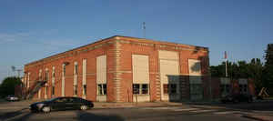
Bonner County is a county located in the northern part of the state of Idaho. Based on the 2010 census, the
population was 40,877. Bonner county was
created in 1907. The
county seat and largest city is Sandpoint.
Bonner county is named for Edwin L. Bonner, a ferry
operator.
Bonner County comprises the Sandpoint, ID Micropolitan Statistical Area.
Etymology - Origin of Bonner County Name
Bonner County is named for Edwin L. Bonner, a pioneer ferry operator in the area.
Demographics:
County QuickFacts: CensusBureau Quick Facts
Bonner County History
Established February 21, 1907 with its county seat at Sandpoint. It was named for Edwin L. Bonner, who, in 1864, established a ferry on the Kootenai River where the town of Bonners Ferry is located. The ferry became an important site in emigrant travel between Walla Walla to the placer and quartz mines in British Columbia.
Geography: Land and Water
As reported by the Census Bureau, the county has a total area of 1,919 square miles (4,970 km2), of which 1,735 square miles (4,490 km2) is land and 185 square miles (480 km2) (9.6%) is water.
Bonner county is located in north Idaho. Parts of Pacific Northwest National Scenic Trail, Coeur d'Alene National Forest, Kaniksu National Forest, and Kootenai National Forest are located in this county.
Neighboring Counties
Bordering counties are as follows:
- North: Boundary County
- Northeast: Lincoln County, Mont.
- Southeast: Sanders County, Mont.; Shoshone County
- South: Kootenai County
- Southwest: Spokane County, Wash.
- Northwest: Pend Oreille County, Wash.
Education


Click Image to Enlarge
