


Click Image to Enlarge
Idaho Counties
There are forty-four Counties in Idaho. When Idaho became a territory in March, 1863, there were four Counties in existence: Boise, Idaho, Nez Perce and Shoshone. By the time Idaho became a state, there were 15 counties. The rest of the 44 Counties came into existence during the 30 years after Idaho became a state. Two of the former counties disappeared during this time. Alturas, which was created in 1864, was later divided into the many counties now found in central Idaho. Logan County was only in existence for six years, from 1889 to 1895. It was combined with Alturas to form Blaine County and Lincoln County, which was formed just two weeks after Logan lost its identity.Butte County, Idaho
Butte County Education, Geography, and History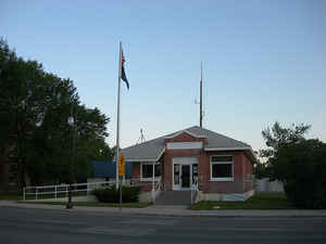
Butte County is a rural county located in the state of Idaho. Based on the 2010 census, the
population was 2,891, making it the
third-least populous county in Idaho. The county was created in 1917.
The county seat and largest city is
Arco. Butte county is named from Buttes rising from the
Snake River Plain.
Butte County is included in the Idaho Falls, ID Metropolitan Statistical Area. Much of the eastern part of the county is the vast Idaho
National Laboratory, which extends eastward into neighboring counties.
Etymology - Origin of Butte County Name
Butte County is named for the buttes that rise from the Snake River Plain, which served as landmarks to trappers and early explorers.
Demographics:
County QuickFacts: CensusBureau Quick Facts
Butte County History
Established February 6, 1917 with its county seat at Arco. It was named for the buttes that rise from the Snake River plain and served as landmarks to trappers and pioneers who traveled through the area. The first white men in the region were thought to be Donald Mackenzie and his Northwest Fur Company trappers in 1818.
Geography: Land and Water
As reported by the Census Bureau, the county has a total area of 2,234 square miles (5,790 km2), of which 2,232 square miles (5,780 km2)
is land and 2.0 square miles (5.2 km2) (0.1%) is water.
Butte county is located close to the center of Idaho.
The Little Lost River is located in Butte County. Its waters, along with the Big Lost River, disappear from the surface to flow underground
into the Snake River Plain aquifer in Butte County.
The county was named for the volcanic buttes that rise from the desert plain; the largest is Big Southern Butte, located in the southern part
of the county. It rises 2,500 feet (760 m) above the desert floor and was used as a landmark by pioneers.
The southwestern portion of the county includes the visitor center at the Craters of the Moon National Monument and Preserve, which extends
south & west into three other counties
Neighboring Counties
Bordering counties are as follows:
- Northeast: Clark County
- East: Jefferson County
- Southeast: Bingham County
- Southwest: Blaine County
- Northwest: Custer County; Lemhi County
Education


Click Image to Enlarge
