


Click Image to Enlarge
Idaho Counties
There are forty-four Counties in Idaho. When Idaho became a territory in March, 1863, there were four Counties in existence: Boise, Idaho, Nez Perce and Shoshone. By the time Idaho became a state, there were 15 counties. The rest of the 44 Counties came into existence during the 30 years after Idaho became a state. Two of the former counties disappeared during this time. Alturas, which was created in 1864, was later divided into the many counties now found in central Idaho. Logan County was only in existence for six years, from 1889 to 1895. It was combined with Alturas to form Blaine County and Lincoln County, which was formed just two weeks after Logan lost its identity.Lewis County, Idaho
Lewis County Education, Geography, and History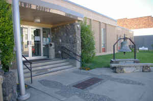
Lewis County is a county located in the north central region of the state of Idaho. Based on the 2010 census, the
population was 3,821, making it the fourth-least
populous county in Idaho. Lewis county was created 1911.
The county seat is Nezperce. The
county is named after the explorer Meriwether Lewis.
Most of the county is within the Nez Perce Indian Reservation, though Native Americans comprise less than 6% of the county population. Similar
to the opening of lands in Oklahoma, the US government opened the reservation for white settlement in November 1895. The proclamation had
been signed less than two weeks earlier by President Cleveland.
Etymology - Origin of Lewis County Name
Lewis County is named for Meriwether Lewis, a co-leader of the Lewis and Clark Expedition.
Demographics:
County QuickFacts: CensusBureau Quick Facts
LewisCounty History
Established on March 3, 1911, the county is named after Meriwether Lewis of the Lewis and Clark Expedition. The Nez Perce Indians made this area their home and knew no whites until the Expedition spent a month in the Clearwater River Valley (near the town of Kamiah) after returning from the Pacific Coast in May 1806.
Geography: Land and Water
As reported by the Census Bureau, the county has a total area of 480 square miles (1,200 km2), of which 479 square miles (1,240 km2) is land and 0.9 square miles (2.3 km2) (0.2%) is water.
Lewis county is located in northwest Idaho. The county is the fourth-smallest county in Idaho by area. The county contains the northern portion of the Camas Prairie, an elevated prairie-like region of the middle Columbia basin, south of the Clearwater River. The Clearwater River forms the eastern boundary of Lewis County, just upstream of where the Lewis and Clark Expedition put their canoes in the water for the trip to the Pacific Ocean.
Neighboring Counties
Bordering counties are as follows:
- Northeast: Clearwater County
- Southeast: Idaho County
- Northwest: Nez Perce County
Education


Click Image to Enlarge
