


Click Image to Enlarge
Mississippi Counties
There are eighty counties in Mississippi. Two original counties were Adams County and Jefferson County (formerly Pickering) established in 1799Attala County, Mississippi
Attala County Education, Geography, and History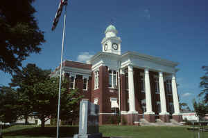
Attala County is a county located in the state of Mississippi. Based on the 2010 census, the population was 19,564. Its county seat is Kosciusko. Attala County is named for Atala, a fictional Native American heroine from an early-19th-century novel of the same name by François-René de Chateaubriand.
Etymology - Origin of Attala County Name
Attala is named for Attala or Atala, a fictional Native American heroine from an early 19th Century novel by Fran?is-Ren?de Chateaubriand.
Demographics:
County QuickFacts: CensusBureau Quick Facts
Attala County History
Attala County was established on the 23d of December, 1833, and was one of the sixteen counties carved from the Choctaw cession of 1830. The name is derived from the heroine (Atala) of an Indian romance written by Chateaubriand. As Attala has the distinction of retaining its original boundaries, as laid down in 1833, they are quoted, as follows:
"Beginning at the northeast corner of Leake County, and running thence west with the line between townships, 12 and 13, to the line between ranges five and six east; thence south with said line between ranges five and six to the center of township 12, of range 5 east; thence directly west to the Big Black River; thence up said river to the point at which the line between 16 and 17 crosses said river; thence east with the line between nine and ten east; thence south to the place of beginning."
The Choctaw boundary line of 1820 (treaty of Doak's Stand) runs through the extreme southwestern corner of the
county. Kosciusko is the largest town and the county seat of Attala County.
The Attala County Court House has burned on three separate occasions. The first fire on 28 July 1858 was the most
devastating as all records were destroyed. For this reason, no records exist prior to August 1858. The second fire
was in July 1860 and although the records on hand were somewhat meager, none were lost. The third fire occured on 26
July 1896 and some records were lost including the county marriage records.
Geography: Land and Water
As reported by the Census Bureau, the county has a total area of 737 square miles (1,909 km2), of which, 735
square miles (1,904 km2) of it is land and 2 square miles (5 km2) of it (0.27%) is water.
Neighboring Counties
Bordering counties are as follows:
- Montgomery County (north)
- Choctaw County (northeast)
- Winston County (east)
- Leake County (south)
- Madison County (southwest)
- Holmes County (west)
- Carroll County (northwest)
Education


Click Image to Enlarge
