


Click Image to Enlarge
Mississippi Counties
There are eighty counties in Mississippi. Two original counties were Adams County and Jefferson County (formerly Pickering) established in 1799Clay County, Mississippi
Clay County Education, Geography, and History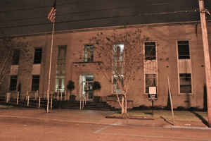
Clay County is a county located in the state of Mississippi. Based on the 2010 census, the population was 20,634. Its county seat is West Point. Its name is in honor of American statesman Henry Clay, member of the United States Senate from Kentucky and United States Secretary of State in the 19th century.
Etymology - Origin of Clay County Name
Clay is named for Speaker of the US House of Representatives Henry Clay. Henry Clay, Sr. (April 12, 1777 - June
29, 1852) was a nineteenth-century American statesman and orator who represented Kentucky in both the House of
Representatives and Senate.
He was a dominant figure in both the First Party System to 1824, and the Second Party System after that. Known as
"The Great Compromiser" and "The Great Pacifier" for his ability to bring others to agreement, he was the founder
and leader of the Whig Party and a leading advocate of programs for modernizing the economy, especially tariffs to
protect industry, a national bank, and internal improvements to promote canals, ports and railroads.
Demographics:
County QuickFacts: CensusBureau Quick Facts
Clay County History
Clay County was erected May 12, 1871, during the administration of Governor Alcorn, and marks the southern boundary line of the old Chickasaw Indian territory. It was originally organized from parts of Chickasaw, Lowndes, Monroe and Oktibbeha Counties, and named Colfax after Schuyler Colfax, a Republican. In 1876, after the Democrats came into power and had thrown off carpetbag rule, the name was changed to Clay in honor of the great Kentuckian.
Its county seat is West Point, located at the junction of three lines of railway- the Illinois Central, the Southern,
and the Mobile and Ohio. Within easy distance of the Alabama coal fields and possessed of excellent railroad
facilities.. There are no other large towns in the county, though there are a number of thriving small ones, among
which may be mentioned Cedar Bluff, Pheba, Montpelier, Abbott, Griffith and Siloam. The Tombigbee River washes a
part of its eastern border and the Tibbee, Line Houlka, Sun, Chewah and Chuquatonchee creeks, tributaries of the
Tombigbee, afford it ample water. The three lines of railway above mentioned give the county excellent shipping
facilities and many northern settlers are now coming into this region.
Geography: Land and Water
As reported by the Census Bureau, the county has a total area of 416 square miles (1,077 km2), of which, 409
square miles (1,058 km2) of it is land and 7 square miles (19 km2) of it (1.79%) is water.
Neighboring Counties
Bordering counties are as follows:
- Chickasaw County (north)
- Monroe County (northeast)
- Lowndes County (southeast)
- Oktibbeha County (south)
- Webster County (west)
Education
Clay County is within the service area of the East Mississippi Community College system


Click Image to Enlarge
