


Click Image to Enlarge
Mississippi Counties
There are eighty counties in Mississippi. Two original counties were Adams County and Jefferson County (formerly Pickering) established in 1799Coahoma County, Mississippi
Coahoma County Education, Geography, and History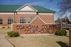
Coahoma County is a county located in the state of Mississippi. Based on the 2010 census, the population was 26,151. Its county seat is
Clarksdale.
The Clarksdale, MS Micropolitan Statistical Area includes all of Coahoma County. It is located in the Mississippi Delta region of Mississippi.
Etymology - Origin of Coahoma County Name
Coahoma County was given a name meaning "red panther", from the Choctaw words `ko-i' ("panther", "wildcat") and `humma' or `homa' ("red"), but it is not known with certainty why this name was given. There is a tradition that the county was named for Princess Coahoma Sheriff, "Sweet Coahoma", who was the daughter of a Choctaw chieftain named Sheriff. This seems improbable, if for no other reason than that Coahoma was a man's name among the Muscogee peoples. Another suggestion is that the county may have been named for a stream called Coahoma. It does seem likely that this name, like several other county names, was suggested by Alexander G. McNutt. Even though the county lies in the Choctaw district, it was formed at the time of the creation of counties in the Chickasaw district. Since other counties formed at the same time were named for Tishomingo and for Itawamba (Levi Colbert), it seems at least reasonable to suppose that Coahoma County may have been named for William McGilvery (sometimes given as McGillivray), whose Indian name is said to have been Coahoma and who, like Levi Colbert, was a mixed-blood Chickasaw district chief during the time between the Treaty of Chickasaw Council House in 1816 and removal during the 1830s.
Demographics:
County QuickFacts: CensusBureau Quick Facts
Coahoma County History
Coahoma County, an original county of the Choctaw Cession of 1830, was the eleventh county established by the act of February 9, 1836. Formed under Second Constitution (1832-1869), March 1, 1836 {Divided, February 19, 1892 - June 3, 1930} , and is located in the northwestern part of the State in the fertile Yazoo Delta region. The name "Coahoma" is a Choctaw word signifying "red panther." The act creating the county defined its limits as follows:
"Beginning at the point where the line between townships 24 and 25 of the surveys of the late Choctaw cession intersects the Mississippi River, and running thence up the said river to the point where the dividing line between the Choctaw and Chickasaw tribes of Indians intersects the same; thence with the dividing line to the point where the line between ranges two and three of the survey of the said Choctaw cession intersects the same; thence with said range line, to the line between townships 24 and 25 aforesaid, and thence with the said township line to the beginning."
The county has a land surface of 530 square miles. It constitutes one of the numerous counties formed from the
Choctaw cession of 1830. In 1877 the county relinquished a part of its territory to Quitman.
Port Royal was once the county seat of Coahoma County. It was a rival of Friar's Point, five miles up the
Mississippi River. In the early days the county seats of the Mississippi River counties were always located on the
banks of that stream. When Port Royal was cut off from the river in 1848, its fate was sealed and the county seat of
justice was located at Friar's Point, which still remained a river town. It received its name in honor of Robert
Friar, one of its earliest settlers. Clarksdale, one of the county seats, is now the largest and most important city
in the county. Clarksdale was named for John Clark, a brother-in-law of Governor Alcorn, whose beautiful home,
Eagle's Nest, was in this county. The main line of the Yazoo & Mississippi Valley railway, together with four
branches of the same road, afford the county excellent railroad facilities. From Coahoma in the northeastern part of
the county, two branches cross in a southwesterly direction, one of which, branching at Clarksdale, crosses the
southeastern part of the county.
Geography: Land and Water
As reported by the Census Bureau, the county has a total area of 583 square miles (1,510 km2), of which, 554
square miles (1,435 km2) of it is land and 29 square miles (75 km2) of it (4.97%) is water.
Neighboring Counties
Bordering counties are as follows:
- Tunica County (north)
- Quitman County (east)
- Tallahatchie County (southeast)
- Bolivar County (southwest)
- Phillips County, Arkansas (west)
Education
Colleges
Coahoma Community College (Clarksdale)
Coahoma County was previously in the service area of the Mississippi Delta Community College (MDCC). As a result of the 1995 Mississippi
Legislature session, Coahoma County is no longer in the MDCC service area.
Public School Districts
Clarksdale Municipal School District
Coahoma County School District
Private Schools
Lee Academy (Clarksdale)


Click Image to Enlarge
