


Click Image to Enlarge
Mississippi Counties
There are eighty counties in Mississippi. Two original counties were Adams County and Jefferson County (formerly Pickering) established in 1799Grenada County, Mississippi
Grenada County Education, Geography, and History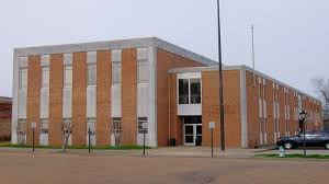
Grenada County is a county located in the state of Mississippi. Based on the 2010 census, the population was 21,906. Its county seat is
Grenada. The county is named for the province of Granada in southern Spain.
The Grenada, MS Micropolitan Statistical Area includes all of Grenada County.
Etymology - Origin of Grenada County Name
Grenada is named for the Spanish province of Granada. Granada is a province of southern Spain, in the eastern part of the autonomous community of Andalusia. It is bordered by the provinces of Albacete, Murcia, Almer?, Ja?, C?doba, M?aga, and the Mediterranean Sea. Its capital is Granada
Demographics:
County QuickFacts: CensusBureau Quick Facts
Grenada County History
Grenada County, which is situated in the north-central part of the State and was created May 9, 1870, from territory formerly belonging to the counties of Carroll, Yalobuska, Choctaw and Tallahatchie. It originally formed part of the territory ceded by the Choctaws by the treaty of Dancing Rabbit in 1830. It was named for the Spanish province of Grenada.
Grenada is at the center of the county, is the only large place and the county seat. When Grenada County was created on May 9, 1870, the seat of justice was established at Grenada, but the history of the old town dates back to the earliest settlements on the Yalobusha River. The city was thus described by a writer in 1838: "Grenada is by far the most important town in the county, (Yalobusha), and is situated on a beautiful plain extending from the south bank of the Yalobusha River, in a southern direction, and seems as if designed for the location of an important place.
Geography: Land and Water
As reported by the Census Bureau, the county has a total area of 449 square miles (1,164 km2), of which, 422
square miles (1,092 km2) of it is land and 28 square miles (71 km2) of it (6.14%) is water.
Neighboring Counties
Bordering counties are as follows:
- Yalobusha County (north)
- Calhoun County (east)
- Webster County (east-southeast)
- Montgomery County (southeast)
- Carroll County (south)
- Leflore County (west)
- Tallahatchie County (northwest)
Education


Click Image to Enlarge
