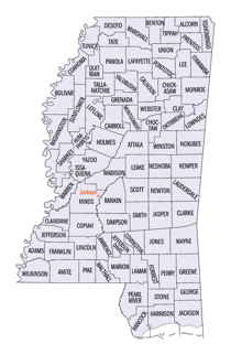
Itawamba County, Mississippi
Itawamba County Education, Geography, and History
Itawamba County is a county located in the state of Mississippi. Based on the 2010 census, the population was 23,401. Its county seat is
Fulton. The county was named for the Chickasaw leader Itawamba, known to English-speaking settlers as Levi Colbert. He was prominent during
the Indian Removal period of the early 19th century, but died before his people left the area.
The county is part of the Tupelo, MS Micropolitan Statistical Area.
Etymology - Origin of Itawamba County Name
Itawamba is named for Levi Colbert, a Chickasaw leader who was called Itte-wamba Mingo, meaning bench chief.
Demographics:
County QuickFacts: CensusBureau Quick Facts
Itawamba County History
Itawamba County was erected February 9, 1836, during the administration of Gov. Charles Lynch. Some Mississippi historians assert that it was named for the daughter of an Indian chief, while others insist that it is a Chickasaw name of Levi Colbert.
In 1832, the treaty of Pontotoc had been concluded with the Chickasaw nation of Indians, whereby they finally ceded to the United States all their remaining lands in the northern part of the State. Out of this large and fertile territory, a dozen counties had been created by the close of the year 1836, one of them being Itawamba. Its original limits were defined as follows:
"Beginning at the point where the line between townships 6 and 7 intersects the eastern boundary of the State, and running with the said boundary line to a point one mile north of its intersection with the line between townships 11 and 112; thence due west to the line between ranges 5 and 6 east; thence north with the said range line, to the line between townships 6 and 7, and thence east with the said township line, to the beginning."
October 26, 1866, it contributed a large part of its western territory, to assist in forming the county of Lee and a few years later the dividing line between Itawamba and the counties of Prentiss and Tishomingo was defined by a line running east from the southwest corner of section 14, between sections 14 and 23, township 7, to the eastern boundary line of the State. In common with all of this Chickasaw region, Itawamba County had been rapidly settled by a strong tide of emigration, not only from the older counties of the State, but from the states of Tennessee, Alabama and Georgia as well. The Indians, reluctant at first to abandon their homes, by the close of the year 1839, had nearly all retired to their new allotments west of the Mississippi River.
Geography: Land and Water
As reported by the Census Bureau, the county has a total area of 540 square miles (1,400 km2), of which, 532
square miles (1,379 km2) of it is land and 8 square miles (21 km2) of it (1.50%) is water.
Neighboring Counties
Bordering counties are as follows:
- Tishomingo County (northeast)
- Franklin County, Alabama (east)
- Marion County, Alabama (southeast)
- Monroe County (south)
- Lee County (west)
- Prentiss County (northwest)
Education


