


Click Image to Enlarge
Mississippi Counties
There are eighty counties in Mississippi. Two original counties were Adams County and Jefferson County (formerly Pickering) established in 1799Lawrence County, Mississippi
Lawrence County Education, Geography, and History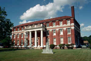
Lawrence County is a county located in the state of Mississippi. Based on the 2010 census, the population was 12,929. Its county seat is Monticello. The county is named for the naval hero James Lawrence.
Etymology - Origin of Lawrence County Name
Lawrence is named for naval leader James Lawrence, famous for the Battle of Lake Erie during the War of 1812.
Demographics:
County QuickFacts: CensusBureau Quick Facts
Lawrence County History
Lawrence County was one of the fourteen territorial counties represented in the constitutional convention of 1817, having been created December 22, 1814, from the older county of Marion. It originally embraced the eastern half of the present county of Lincoln. The original act defined its boundaries as follows:
"Beginning on the Franklin County line, where the middle section of the fifth township intersects the same; thence east along the said line to its intersection with the eastern boundary line of the county of Marion. And all that tract of country on the north side of said line, and within the original boundary of Marion County, shall form a county, known by the name of Lawrence."
By act of January 5, 1819, it contributed of its eastern area to form the
county of Covington, and February 12th, of the same year, it surrendered to
Marion County the northern half of township 5, ranges 17 and 18; in 1870, it
contributed of its western area to form the county of Lincoln and in 1906, a
part of its territory was detached in the formation of Jefferson Davis
County.
The county was named in commemoration of James Lawrence, captain of the
Chesapeake in the memorable battle with the British on Lake Erie. It is an
old settled region in the south central part of the State, and its hardy and
vigorous pioneers contributed largely to the early beginnings of
Mississippi.
The little village of Monticello is situated on a high bluff on the western
bank of the Pearl River, is the county seat; it was the home of Harmon
Runnels, Hiram G., Harmon M. and Hardin D. Runnels, his sons. Harmon Runnels
came to the State from Georgia, built the first house in Monticello and was
a forceful representative in the constitutional convention of 1817. He
reared a large family, which became influential in the annals of the State.
Hiram G. Runnels, one of the sons, became Governor of the State in 1833.
Geography: Land and Water
As reported by the Census Bureau, the county has a total area of 436
square miles (1,129 km2), of which, 431 square miles (1,115 km2) of it is
land and 5 square miles (13 km2) of it (1.17%) is water.
Neighboring Counties
Bordering counties are as follows:
- Simpson County (northeast)
- Jefferson Davis County (east)
- Marion County (southeast)
- Walthall County (south)
- Lincoln County (west)
- Copiah County (northwest)
Education


Click Image to Enlarge
