


Click Image to Enlarge
Mississippi Counties
There are eighty counties in Mississippi. Two original counties were Adams County and Jefferson County (formerly Pickering) established in 1799Leake County, Mississippi
Leake County Education, Geography, and History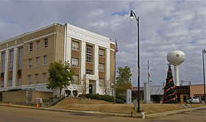
Leake County is a county located in the state of Mississippi. Based on the 2010 census, the population was 23,805. Its county seat is Carthage. The county is named for Walter Leake, the Governor of Mississippi from 1822 to 1825.
Etymology - Origin of Leake County Name
Leake is named for Governor of Mississippi Walter Leake
Demographics:
County QuickFacts: CensusBureau Quick Facts
Leake County History
Leake County was established December 23, 1833, and was one of the sixteen counties created at that time from the final cession of the Choctaw Indians under the treaty of Dancing Rabbit in 1830. Leake County was named for Walter Leake (1762-1825), a native of Virginia who had a distinguished political career in Mississippi after narrowly losing a race for Congress to Thomas Randolph, a close political associate of Thomas Jefferson. Jefferson, to protect Randolph's political future in Virginia, appointed Leake chief judge of Mississippi Territory in 1807. Leake was a member of the 1817 Constitutional Convention, one of Mississippi's first two United States Senators (1817-1820), and a judge of the Mississippi Supreme Court (1821-1822). Elected Governor in 1821 and re-elected in 1823, he was the State's first two-term Governor. He died in office on November 17, 1825, not long after moving from Claiborne County to his new home at Mount Salus in Hinds County. The seat of justice of Greene County was named for him in 1826. Its limits were defined in the original act as follows:
"Beginning at the northeast corner of Scott County, and running from thence north with the line between ranges 9 and 10 east, to the line between townships 12 and 13; from thence west, with the line between townships 12 and 13, to the line between ranges 5 and 6 east; from thence south with said line between ranges 5 and 6 east, to the line between townships 8 and 9; and from thence east to the place of beginning."
The county is an exact square, contains 16 townships or 576 square miles. Carthage, near the center, two miles north of Pearl River, is the county seat. Carthage probably was named for Carthage, Tennessee, from which many prominent early settlers had migrated. Some of the important settlements are Walnut Grove, Edinburg, Standing Pine and Goodhope. As early as 1837 it possessed a population of 1,136 whites and 531 slaves.
Geography: Land and Water
As reported by the Census Bureau, the county has a total area of 585 square miles (1,516 km2), of which, 583 square miles (1,509 km2) of it is land and 3 square miles (7 km2) of it (0.46%) is water.
Neighboring Counties
Bordering counties are as follows:
- Attala County (north)
- Neshoba County (east)
- Scott County (south)
- Madison County (west)
Education


Click Image to Enlarge
