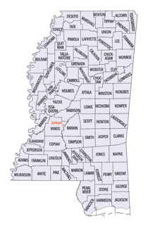
Noxubee County, Mississippi
Noxubee County Education, Geography, and History
Noxubee County is a county located in the state of Mississippi. Based on the 2010 census, the population was 11,545. Its county seat is Macon. The name is derived from the Choctaw word nakshobi meaning to stink
Etymology - Origin of Noxubee County Name
Noxubee is a Native American word meaning stinking water.
Demographics:
County QuickFacts: CensusBureau Quick Facts
Noxubee County History
Noxubee County is located in the fertile prairie region of eastern Mississippi, on the Alabama border. It was established December 23, 1833, and its name is derived from an Indian word, as are many of our geographical names. It is one of the sixteen counties formed from the Choctaw cession of 1830 and its original boundaries were as follows:
"Beginning on the Tombeckbee River, at the point at which the line between townships 16 and 17 strikes the said Tombeckbee River, and from thence west with said line between townships 16 and 17, to the line between ranges 14 and 15 east; and from thence south with said line between ranges 14 and 15 east, to the line between townships 12 and 13; from thence east, with said line between townships 12 and 13, to the line between the State of Alabama and the State of Mississippi, and from thence a northern direction with said line... to the Tombeckbee River, and from thence up said river to the place of beginning."
The original limits as thus defined have not been changed. The total area of the county is about 18 townships, or
682 square miles.
Prior to the formation of Noxubee county, on December 23, 1833, which was the first of the counties to be "given a
name", the land was considered to be in Lowndes county. Lowndes county was originally drawn out of Monroe county in
January of 1830. Then, at the end of 1831, December 6th, it was extended to cover the land which was to become
Noxubee county. One might be aware that if they are looking for records between 1830 and 1834 for persons thought to
be in Noxubee county, Lowndes county is where they should be searching.
Two of the early settlements were at Boundstown, so called from its first settler, Jesse Bounds, and the town of
Brooklyn. Boundstown never got beyond the rough country village stage, and was soon absorbed by the neighboring town
of Brooklyn, situated on the Noxubee River, eight miles east of Shuqualak. The river never proved to be navigable for steamboats, and by the outbreak of the War for Southern
Independence the town was dead.
It was in this county, between the two prongs of Dancing Rabbit Creek, that the famous treaty of Dancing Rabbit was
made and signed, September 27th, 1830, whereby the Choctaw Indians relinquished to the United States all their
remaining lands east of the Mississippi. The commissioners for the United States were Maj. John H. Eaton and Col.
John Coffee. Some six thousand Indians, men, women and children, from first to last were encamped on the creek, and
participated in the discussions leading up to the treaty through their Mingoes, chiefs, captains and warriors, chief
among whom were the celebrated Colonel Leflore, Mu-shu-la-tub-bee, Nittakechi and Little Leader. Eye-witnesses to
the signing of the treaty were two pioneer settlers of the county, Hilcar Burwell and G.W. Campbell.
The first court in the county was held in the log house of Joseph H. Frith, on the present site of Macon, the county
seat. Here, in the late '30s, a two storied brick courthouse, with porticoes and marble columns was built and used
until a more commodious building costing $60,000 was erected just before the war. The present fine courthouse was
erected in 1900.
Geography: Land and Water
As reported by the Census Bureau, the county has a total area of 700 square miles (1,813 km2), of which, 695
square miles (1,800 km2) of it is land and 5 square miles (14 km2) of it (0.75%) is water.
Neighboring Counties
Bordering counties are as follows:
- Lowndes County (north)
- Pickens County, Alabama (east)
- Sumter County, Alabama (southeast)
- Kemper County (south)
- Winston County (west)
- Oktibbeha County (northwest)
Education
Noxubee County is within the service area of the East Mississippi Community College system. The system offers classes in the Macon Extension at Noxubee County High School in Macon


