


Click Image to Enlarge
Mississippi Counties
There are eighty counties in Mississippi. Two original counties were Adams County and Jefferson County (formerly Pickering) established in 1799Sharkey County, Mississippi
Sharkey County Education, Geography, and History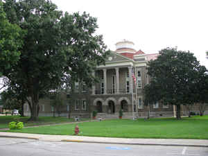
Sharkey County is a county located in the state of Mississippi. Based on the 2010 census, the population was 4,916, making it the
second-least populous county in Mississippi. Its county seat is Rolling Fork. The county is named after William L. Sharkey, the provisional
Governor of Mississippi in 1865.
Sharkey County is located in the Mississippi Delta region.
Etymology - Origin of Sharkey County Name
Sharkey is named for provisional Governor of Mississippi William L. Sharkey.William Lewis Sharkey (July 12, 1798 - April 29, 1873) was an American judge and politician from Mississippi. He was born in Sumner County, Tennessee, where he and his family lived until they moved to Warren County, Mississippi, when he was six years of age. In 1822, he was accepted into the bar at Natchez. Three years later he moved to Vicksburg and after a few years was elected for a single term to the state House of Representatives (1828-1829). He served briefly in 1832 as a circuit court judge before being elected a justice to the state supreme court later that year where he remained for 18 years until his resignation. Sharkey was appointed to the office of Secretary of War by US President Millard Fillmore in 1851, but declined.
Demographics:
County QuickFacts: CensusBureau Quick Facts
Sharkey County History
Sharkey County , which could be called one of the black counties, was organized March 29, 1876, and was named for Judge William L. Sharkey, provisional governor of the State in 1865. It was originally carved from territory belonging to the counties of Warren, Washington and Issaquuena. In 1918, it relinquished a part of its area to the new county of Humphreys, to the northeast. Deer Creek runs entirely through Sharkey County.
Geography: Land and Water
As reported by the Census Bureau, the county has a total area of 435 square miles (1,126 km2), of which, 428
square miles (1,108 km2) of it is land and 7 square miles (19 km2) of it (1.65%) is water.
Neighboring Counties
Bordering counties are as follows:
- Washington County (north)
- Humphreys County (northeast)
- Yazoo County (east)
- Issaquena County (south & west)
Education
Public School Districts
South Delta School District
Private Schools
Sharkey-Issaquena Academy (Rolling Fork)


Click Image to Enlarge
