


Click Image to Enlarge
Mississippi Counties
There are eighty counties in Mississippi. Two original counties were Adams County and Jefferson County (formerly Pickering) established in 1799Warren County, Mississippi
Warren County Education, Geography, and History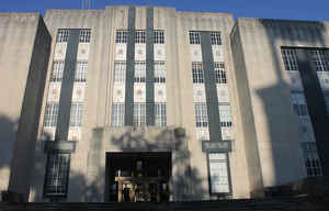
Warren County is a county located in the state of Mississippi. Based on the 2010 census, the population was 48,773. Its county seat is Vicksburg. Created by legislative act of 22 December 1809, Warren County is named for American Revolutionary War officer Joseph Warren.
Etymology - Origin of Warren County Name
Warren is named for American Revolutionary War officer Joseph Warren
Demographics:
County QuickFacts: CensusBureau Quick Facts
Warren County History
Warren County was established by act of the General Assembly, December 22, 1809, which declared that "all that part of the Mississippi territory which lies north of the river Big Black, is hereby erected into a new county, which shall be hereafter called and known by the name of Warren."It was named in honor of Gen. Joseph Warren, officer in the Continental army, who fell at the battle of Bunker Hill. It formerly included within its limits a part of old Washington and the present counties of Issaquena and Sharkey. Its last relinquishment of territory was in 1876, when Sharkey County received a contribution. The northeastern boundary line between Warren and Yazoo counties was the subject of repeated legislation prior to the year 1850 and as now established, is a jagged line connecting the Big Black and Yazoo rivers. Its present area is 572 square miles.
Warren County comprised the northernmost part of the old "Natchez District"and the whole region is replete with
historic interest. As early as 1718, the Mississippi Company, chartered by France, which was then in possession of the
Mississippi Valley, attempted to locate settlers on the Yazoo River by making extensive land grants along that stream.
When the eighteenth century closed, a few inhabitants were distributed near the Walnut Hills, and near the Big Black
River, in the present county of Warren. With the opening of the Natchez Trace a considerable emigration from the States
of Georgia, Tennessee, Kentucky and western Pennsylvania, composed of men of capital and enterprise, began to stream
into the Natchez District and the settlements in the region of Warren County were largely augmented. In 1803, a land
office was established at Washington in Adams County, which adjudicated private claims to a large portion of the lands
within the limits of the white settlements near the Mississippi, claimed and occupied in large part by virtue of grants
or titles derived through the authorities of England, Spain and the State of Georgia. The commission of the land office
at Washington concluded its labors in 1807, after recording two thousand and ninety claims, and thus were settled many
of the early titles along the Yazoo, Big Black and Mississippi rivers in Warren County. Until the year 1798, the
Spaniards maintained a fort and garrison at the "Walnut Hills,"just north of the present city limits of Vicksburg, but
never made any serious effort to colonize the region.
The early county seat of Warren was at Warrenton (incorporated in 1820), 12 miles down the river from Vicksburg, which
as late as 1861 had a population of six to eight hundred, but had only 40 people by 1920.
Though an old historic fort and village, it was not until 1824 that the present city of Vicksburg was laid out and a
charter obtained in 1825, and not until 1836 that the seat of justice was changed to Vicksburg by a vote of the people.
The founder, Rev. Newitt Vick, gave his name to the city that was to be, but it was not surveyed into lots until after
his death. Then his son-in-law, Rev. John Lane, the administrator with the will annexed, after a legal contest, carried
out Mr. Vick's intentions. The site of Vicksburg at the junction of the Yazoo and Mississippi rivers, and the first high
land on the east bank of the Mississippi river for over four hundred miles, was meant by nature for a large commercial
center.
In the old days Vicksburg was a social center for the aristocracy of the State, while the many magnificent steamers,
which plied the Mississippi and Yazoo rivers, brought rich tribute to its port, from the fertile Yazoo-Mississippi Delta
above, and from the rich alluvial lands of Louisiana on the south. The city, one of the most historic of the South, has
had a stormy and checkered career. It emerged from the horrors of the long siege and bombardment in the War between the
States, only to suffer a disastrous fire in 1866; a cut off by the river in 1876, a scourge of yellow fever in 1878, and
another large fire in 1883, while its citizens lost more than a million dollars in the collapse of the Mississippi
banks.
Geography: Land and Water
As reported by the Census Bureau, the county has a total area of 619 square miles (1,603 km2), of which, 587
square miles (1,519 km2) of it is land and 32 square miles (83 km2) of it (5.20%) is water.
Neighboring Counties
Bordering counties are as follows:
- Issaquena County (north)
- Yazoo County (northeast)
- Hinds County (east)
- Claiborne County (south)
- Tensas Parish, Louisiana (southwest)
- Madison Parish, Louisiana (west)
Education


Click Image to Enlarge
