


Click Image to Enlarge
Mississippi Counties
There are eighty counties in Mississippi. Two original counties were Adams County and Jefferson County (formerly Pickering) established in 1799Washington County, Mississippi
Washington County Education, Geography, and History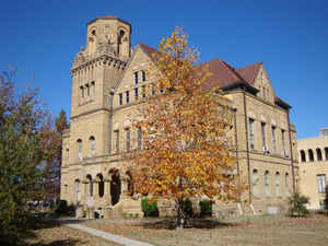
Washington County is a county located in the state of Mississippi. Based on the 2010 census, the population was 51,137. Its county seat
is Greenville. The county is named in honor of the first President of the United States, George Washington.
The Greenville, MS Micropolitan Statistical Area includes all of Washington County. It is located in the Mississippi Delta.
Etymology - Origin of WashingtonCounty Name
Washington is named for US President George Washington.
Demographics:
County QuickFacts: CensusBureau Quick Facts
Washington County History
Washington County was created January 29, 1827 from Warren and Yazoo Counties. It was named for President George Washington and was one of the numerous counties formed from the so-called "New Purchase", acquired from the Choctaws by the treaty of Doak's Stand, October 20, 1820. Washington County was created by an act which recited that
"So much of the counties of Warren and Yazoo as lies west of the Yazoo River, beginning on the right bank of said river, where the Choctaw boundary line strikes the same; thence along said boundary to the Mississippi River; thence down the said river, to a point on the said river, where the east and west line between townships seventeen and eighteen strikes the same; thence along said line, to where the same strikes the Yazoo River; thence up the said last mentioned river, to the place of beginning, shall constitute a county, which shall be called the county of Washington."
This created a triangular area, with the base on the Mississippi River and the apex on the Yazoo River. Sections two to nine of the same act organized the county. An act of February 12, 1828, declared the line between Warren and Washington counties to begin on the east bank of the Mississippi, "at the upper end of the plantation of Nerry Henley, and run so as to intersect the line between the counties of Warren and Yazoo, where the same strikes the Yazoo River", and appointed commissioners to run the line. February 9, 1839, the line between the said counties was defined again as follows:
"commencing at the point on the Yazoo River, where the southern boundary of township nine, range six west of the Choctaw district, intersects it; thence running west on the southern boundary of township nine, range six, seven, eight, and nine, west to the Mississippi river."
January 23, 1844, all that part of Washington County south of a line commencing on the Mississippi River between
townships 13 and 14, and running east, between said townships, to the western boundary of Yazoo County, was taken to
form the county of Issaquena. It later surrendered small portions of its territory to Bolivar and Sunflower counties
and finally, on March 29, 1876, it surrendered other portions to help form the new county of Sharkey. Again, in
1918, part of its territory went to the new county of Humphreys.
The county lies wholly within the fertile Yazoo Delta, and many settlers of character and wealth were attracted to
the rich region before its organization, and during the '30s and '40s, coming from the states of Kentucky, Georgia,
Alabama, the Carolinas and the older parts of Mississippi.
Princeton, the first county seat, was at one time the chief town in the county. It was situated on the Mississippi
River, about ten miles above the present southern boundary, and once had a population of about 600 people. After the
county seat was removed to Greenville, Princeton rapidly declined, and is now entirely extinct. The old town of
Greenville was a mile south of the present flourishing town of that name, but having been partially destroyed during
the war and inundated by the river, the county seat was removed to the present point on the river. Greenville has
long been one of the largest and most prosperous towns in the State; it had a population in 1900 of 7,642, in 1910
of 9,610 and in 1920, of 11,560. Greenville, like Greene County (1811) and the former seat (1802-1826) of Jefferson
County, was named for General Nathanael Greene.
Geography: Land and Water
As reported by the Census Bureau, the county has a total area of 761 square miles (1,972 km2), of which, 724
square miles (1,875 km2) of it is land and 37 square miles (97 km2) of it (4.90%) is water.
Neighboring Counties
Bordering counties are as follows:
- Bolivar County (north)
- Sunflower County (northeast)
- Humphreys County (east)
- Sharkey County (southeast)
- Issaquena County (south)
- Chicot County, Arkansas (west)
Education
Public School Districts
Greenville Public School District
Leland School District
Hollandale School District
Western Line School District
Private Schools
Deer Creek School (Arcola)
Greenville Christian School
Saint Joseph Catholic High School (Greenville)
Washington School (Greenville)
Pillow Academy in unincorporated Leflore County, near Greenwood, enrolls some students from Washington County. It originally was a segregation
academy.


Click Image to Enlarge
