


Click Image to Enlarge
Mississippi Counties
There are eighty counties in Mississippi. Two original counties were Adams County and Jefferson County (formerly Pickering) established in 1799Yazoo County, Mississippi
Yazoo County Education, Geography, and History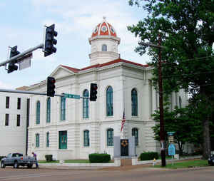
Yazoo County is a county located in the state of Mississippi. Based on the 2010 census, the population was 28,065. The county seat is
Yazoo City. It is named for the Yazoo River, whose name, legend has it, comes from an Indian word meaning "River of Death."
Yazoo County is included in the Jackson-Vicksburg-Brookhaven, MS Combined Statistical Area. It is located in the Mississippi Delta region.
Etymology - Origin of Yazoo County Name
Yazoo It is named for the Yazoo River, whose name, legend has it, comes from an Indian word meaning "River of Death." The Yazoo River was named by French explorer La Salle in 1682 in reference to the Yazoo tribe living near the river's mouth. The exact meaning of the term is unclear. One long held belief is that it means "river of death".
Demographics:
County QuickFacts: CensusBureau Quick Facts
Yazoo County History
Yazoo County was established January 21, 1823. It is situated in the West-central part of the State, in the fertile valley of the Yazoo River, and was created at the same time as the county of Copiah, out of the large county of Hinds. It formed part of the territory acquired from the Choctaws in 1820, long known as the "New Purchase."The original act defined its boundaries as follows:
"Beginning at a point on Big Black River, where the northern boundary line of township seven intersects the same; thence due east along said line to where it strikes Pearl River; thence up said river to where the Choctaw boundary line crosses the same; thence along said boundary line to where it strikes the Mississippi River; thence down said river to the northern boundary line of Warren County; thence along said boundary line to Big Black River; thence with the same to the beginning."
It thus included within its original limits the present counties of Washington, Holmes, Issaquena, and Sharkey,
and parts of the counties of Madison and Sunflower. In 1918 it made its last donation of territory to the new county
of Humphreys.
When Yazoo County was first established, the seat of justice was located at Beattie's Bluff, on the Big Black River,
twelve or fifteen miles northwest of Canton. The first courthouse and the other buildings of the settlement were
made of hewn logs. When, in 1829, the county seat was moved to Benton, the town dwindled away, and its site is now a
cultivated field. In 1828, William Y. Gadberry of South Carolina entered the tract of land on which Benton was
built. It was a place of importance in the early days and was incorporated in 1836. Its first log courthouse was
replaced by a fine two story brick building, and it contained a school house, churches and many elegant residences. McGaughey, and Jas. Blundell. When Yazoo City became the seat of justice
in 1849, the place declined, and it is now a village going to ruin. The rich region embraced in Yazoo County was
rapidly settled after its organization, by a splendid body of pioneers, who poured into the region from the older
parts of Mississippi, and from the Carolinas, Alabama, Georgia, Kentucky and Tennessee. By 1830 the county had
attained a population of 6,500, and by 1837 it had acquired a population of 11,884, including slaves. Since 1850,
its population has been as follows, the noticeable decrease from 1910 to 1920 being due to its territorial reduction
in the formation of Humphreys County: 1850, 14,418; 1860, 22,373; 1870, 17,279; 1880, 33,845; 1890, 36,394; 1900,
43,948; 1910, 46,672; 1920, 37,149.
Yazoo City, the county seat, one of the finest small cities of the State, was known as Manchester until 1838, and is
the largest and most important town in the county. It is located on the left bank of the Yazoo River, near the
center of the county, and in 1920 had a population of 5,244. It suffered a disastrous fire in 1904, but has since
been rebuilt and is now larger than before. It was also burned by General Arthur in 1864, and rebuilt soon after the
war. Yazoo is the home county of John Sharp Williams, so long the brilliant Democratic leader in both houses of
congress. Bentonia, Satartia and Vaughan are among the more important villages in the county. Besides the Yazoo
River, which traverses the county in a winding course for about 140 miles, and the Big Black River, which forms its
southeastern boundary, there are numerous tributary creeks of these streams and Lakes George and Wolf.
Yazoo City, Queen City of the Delta, became the county seat by an election in 1849 but was not the functioning
county seat until sometime in 1851 when the courthouse was completed. The US Census population schedules are
available beginning in 1830. The County Clerk has marriage records dating from 1845
Geography: Land and Water
As reported by the Census Bureau, the county has a total area of 934 square miles (2,419 km2), of which, 919
square miles (2,381 km2) of it is land and 15 square miles (38 km2) of it (1.57%) is water.
The total land area of 934 square miles makes Yazoo County the largest county in Mississippi. In fact, the State of
Rhode Island is only 298 square miles larger.
Neighboring Counties
Bordering counties are as follows:
- Humphreys County (north)
- Holmes County (northeast)
- Madison County (east)
- Hinds County (south)
- Warren County (southwest)
- Issaquena County (west)
- Sharkey County (northwest)
Education
Public School Districts
Yazoo City Municipal School District
Yazoo County School District
Private Schools
Benton Academy (Benton)
Manchester Academy (Yazoo City)
Covenant Christian School (Yazoo City)
Thomas Christian Academy (Yazoo City)


Click Image to Enlarge
