


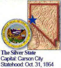
Nevada State Almanac: Facts and Figures
Quick Facts, Figures, and Overview of the State of Nevada
Nevada is one of the Mountain states of the US. By area, it is the seventh biggest state in the country. Nevada covers a total area of 110,562 sq. miles and its neighboring states are California, Oregon, Utah, Idaho, and Arizona. Spanish sailors gazed upon the beautiful mountain ranges of California. They called these mountains Sierra Nevada (snowy range). Sierra Nevada seemed an apt name for the new territory that was being carved out of Utah, but when the deed was done in 1859, the name of this new territory was shortened to Nevada.
Nevada has been known for its mineral wealth and for its gambling casinos and scenic landscapes that attract millions of tourists. By the early
1990s, however, Nevada had developed a relatively diversified economy; tourism, mining, and ranching remain important, but manufacturing and construction
have grown rapidly. Nevada manufactures gaming equipment; lawn and garden irrigation devices; titanium products; seismic and machinery monitoring devices;
and specialty printing. The state's leading agricultural industry is cattle and calves. Agricultural crops consist mainly of hay, alfalfa seed, barley,
wheat, and potatoes.
Nevada Almanac: Facts on the State of Nevada |
|||
|---|---|---|---|
| Official Name | Nevada | ||
| Capital | Carson City | ||
| Nicknames | Sagebrush State; Silver State; Battle Born State ...and more | ||
| Motto | All for our country | ||
| Location Region |
39.14832 N, 119.74324 W Rocky Mountains Southwestern |
||
| Constitution Ratified | 1864 | ||
| Statehood | October 31, 1864 36th state |
||
| Population | 2,700,551 (2010) 18.20 sq. mi. 35th |
||
| Largest City (by population) |
10 largest cities (2010 est.):Las Vegas, 583,756; Henderson, 257,729; Reno, 225,221; Paradise, 225,167; North Las Vegas, 216,961; Sunrise Manor 189,372; Spring Valley, 178,395; Enterprise 108,481; Sparks, 90,264 ; Carson City, 55,274 | ||
| Bordering States | North: Oregon and Idaho East: Utah and Arizona South West and West: California |
||
| Major Industry | tourism, mining (gold, silver), hydro-electric power | ||
| Major Rivers | Colorado River, Humboldt River, Truckee River | ||
| Major Lakes | Pyramid Lake, Lake Mead, Lake Mojave, Lake Tahoe, Walker Lake | ||
| Nevada Counties | 16, plus 1 independent city | ||
| Largest County (by population) |
Clark County 1,951,269 (2010) 7,911 sq. mi. |
||
| Largest County (by area) |
Nye County 18,147 sq. mi. |
||
| State parks | 24 | ||
| Electoral Votes | 5 (as of the 2004 Presidential Election) | ||
| US Congress | 2 Senators; 2 Representatives (3 Representatives as of the 2002 election) | ||
| Time Zone | Pacific Standard Time | ||
| Zip Codes | NANPA | ||
| State Quick Facts | Census Bureau Quick Facts | ||
Nevada Climate and Weather |
|
|---|---|
| Nevada's alpine topography, central and north, and the desert
conditions of the south are as different as day and night. In the southern desert area (Las Vegas), summers are hot, dry and windy. Average
high temperatures are right at 90 degrees. Winters in the desert are usually quite mild, with average highs in the mid-40s, often much higher.
In the central and northern mountain areas, summers are milder with cool mornings. Winter brings much colder temperatures and snow (sometimes heavy), especially in the high mountains of the Lake Tahoe area. Annual precipitation amounts are very low in Nevada, with less than 10 inches common. Some higher elevations in the mountains receive up to 30 inches, and Lake Tahoe approaches 50 inches |
|
| Highest Temperature | 122 degrees June 23, 1954 - Overton |
| Lowest Temperature | -50 degrees January 8, 1937 - San Jacinto |
| Avg. Temp: High - Low |
104.5 degrees - 19.5 degrees |
Nevada Points of Interest |
|
| Colorado River and the Hoover Dam - Lake Mead area, Lake Tahoe, Las Vegas, Reno, the recreation areas at Pyramid Lake, historic Virginia City, Red Rock Canyon, Lake Tahoe, Reno, and Las Vegas are major resorts. Other attractions are Hoover Dam, Virginia City, and Great Basin National Park (includes Lehman Caves), and much, much more. | |
Nevada Highest, Lowest, and Mean Elevations (Feet) |
|
| Mean Elevation: 5,500 feet | |
|
Highest Point: Boundary Peak: 13,140 feet
|
|
| Lowest Point: | Colorado River 479 feet |
Nevada Land Area (Square Miles) |
|
| Geographic Center | In Lander County, 26 mi. SE of Austin Longitude: 116°55.9'W Latitude: 39°30.3'N |
| Total Area | 110,560.71 sq. mi 7th |
| Land Area | 109,825.99 sq. mi 99.34% |
| Water Area | 734.71 sq. mi. 0.66% |
| Forested Land Area | 14.1% |
| Dimensions (Length - Width) |
490 miles - 320 miles |
 Of the 11.86 million acres of
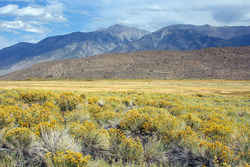
the heavily visited Inyo National Forest split between Nevada and California, only 60,654 lie in Nevada. In that portion, you will find this one
lonely Wilderness, the state's smallest. But this Wilderness makes up in height what it lacks in size, with Boundary Peak, at 13,140 feet, rating
as the highest point in Nevada. The peak overlooks, as might be expected, the California border, and rises above the White Mountains, a high and
dry range from which colorful canyons descend eastward into desert land.
Of the 11.86 million acres of
the heavily visited Inyo National Forest split between Nevada and California, only 60,654 lie in Nevada. In that portion, you will find this one
lonely Wilderness, the state's smallest. But this Wilderness makes up in height what it lacks in size, with Boundary Peak, at 13,140 feet, rating
as the highest point in Nevada. The peak overlooks, as might be expected, the California border, and rises above the White Mountains, a high and
dry range from which colorful canyons descend eastward into desert land.
