

Click Image to Enlarge
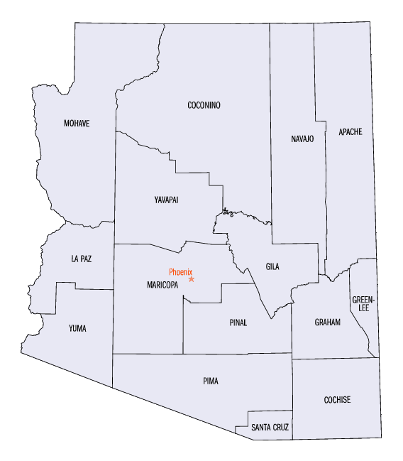
Arizona Counties
There are fifteen Counties in Arizona. There is one defunct county: Pah-Ute County formed in 1865 from Mohave County and returned in 1871. Four Counties (Mohave, Pima, Yavapai and Yuma) were created in 1864 following the organization of the Arizona Territory in 1862. The newest, La Paz County was created in 1983.Arizona Counties: History and Information
Find a brief history of Arizona Counties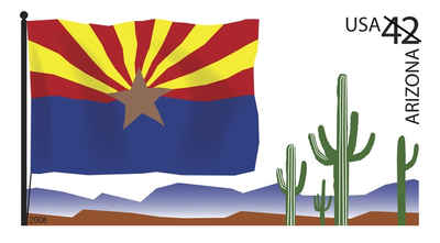
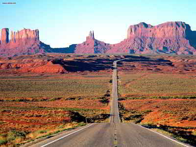
Arizona is located in the southwestern region of the country and is the sixth most extensive and the 16th most populous of the 50 states. Arizona achieved statehood on February 14, 1912. Arizona is noted for its desert climate in its southern half, while the northern half has much more moderate weather with significant snowfalls. Arizona has borders with New Mexico, Utah, Nevada, California, and Mexico, and it has one point in common with the southwestern corner of Colorado. Arizona has a 389 miles long international border with the Mexican states of Sonora and Baja California. Arizona capital and largest city is Phoenix.
There are 15 counties in the state of Arizona. There is also one defunct county: Pah-Ute County was formed in 1865 from Mohave County and returned in 1871. Four counties (Mohave, Pima, Yavapai and Yuma) were created in 1864 following the organization of the Arizona Territory in 1862. All but La Paz County were created by the time Arizona was granted statehood in 1912
The names of many of the counties pay tribute to the state's Native American heritage. Fully nine of the fifteen counties are named after various native groups that are resident in parts of what is now Arizona. Three of the other counties have Spanish names from the language of the early Hispanic explorers of Arizons: La Paz County, Santa Cruz County, and Pinal County. Another county, Graham County, is named for a physical features, Mount Graham, with the final county, Greenlee County, being named after one of the state's early pioneers.
| History of Arizona Counties | ||||
|---|---|---|---|---|
| County | 2000 Population |
Square Miles |
County Seat | Created |
| Apache County | 69,423 | 11,206 | Saint Johns | 1879 |
| Cochise County | 117,755 | 6,170 | Bisbee | 1881 |
| Coconino County | 116,320 | 18,619 | Flagstaff | 1891 |
| Gila County | 51,335 | 4,768 | Globe | 1881 |
| Graham County | 33,489 | 4,630 | Safford | 1881 |
| Greenlee County | 8,547 | 1,847 | Clifton | 1909 |
| La Paz County | 19,715 | 4,500 | Parker | 1983 |
| Maricopa County | 3,072,149 | 9,204 | Phoenix | 1871 |
| Mohave County | 155,032 | 13,312 | Kingman | 1864 |
| Navajo County | 97,470 | 9,954 | Holbrook | 1895 |
| Pima County | 843,746 | 9,187 | Tucson | 1870 |
| Pinal County | 179,727 | 5,370 | Florence | 1875 |
| Santa Cruz County | 38,381 | 1,238 | Nogales | 1899 |
| Yavapai County | 167,517 | 8,124 | Prescott | 1864 |
| Yuma County | 160,026 | 5,514 | Yuma | 1864 |

Click Image to Enlarge
