


Michigan State Almanac: Facts and Figures
Quick Facts, Figures, and Overview of the State of Michigan
Michigan, one of the East North Central states of the US. Michigan consisting mainly of two large peninsulas: the Lower Peninsula and the smaller Upper Peninsula. The state is bounded on the south by the states of Ohio and Indiana, sharing land and water boundaries with both. Michigan's western boundaries are almost entirely water boundaries, from south to north, with Illinois and Wisconsin in Lake Michigan; then a land boundary with Wisconsin and the Upper Peninsula, that is principally demarcated by the Menominee and Montreal Rivers; then water boundaries again, in Lake Superior, with Wisconsin and Minnesota to the west, capped around by the Canadian province of Ontario to the north and east. Michigan's name originally referred to a clearing on the lower peninsula and was derived from the Chippewa Indian word "majigan" which means clearing. Lake Michigan was named after this clearing by European explorers in the area in the 1670's. From Chippewa words mici gama meaning "great water," after the lake of the same name.
Michigan economy, dominated in the 19th century by fur trapping, farming, lumbering, and mining, became highly industrialized after 1900 as the state developed into the major center in production of motor vehicles and parts, it is also a leader in many other manufacturing and processing lines, including prepared cereals, machine tools, airplane parts, refrigerators, hardware, and furniture. The state produces important amounts of iron, copper, iodine, gypsum, bromine, salt, lime, gravel, and cement. Michigan's farms grow apples, cherries, beans, pears, grapes, potatoes, and sugar beets. Michigan's forests contribute significantly to the state's economy, supporting thousands of jobs in the wood-product, tourism, and recreation industries. With 10,083 inland lakes and 3,288 mi of Great Lakes shoreline, Michigan is a prime area for both commercial and sport fishing.
Michigan Almanac: Facts on the State of Michigan |
|||
|---|---|---|---|
| Official Name | Michigan | ||
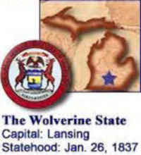
| Capital | Lansing | ||
| Nicknames | Wolverine State ...and more | ||
| Motto | Si Quaeris Peninsulam Amoenam Circumsice (If you seek a pleasant peninsula, look about you) | ||
| Location Region |
42.70910 N, 084.55399 W Midwest Northeastern |
||
| Constitution Ratified | April 1,1963 | ||
| Statehood | January 26, 1837 26th state |
||
| Population | 9,883,640 (2010) 174.94 sq. mi. 8th |
||
| Largest City (by population) |
10 largest cities (2010): Detroit, 713,777; Grand Rapids, 188,040; Warren, 134,056; Sterling Heights, 129,699; Lansing, 114,297; Ann Arbor, 113,934; Flint, 102,434; Dearborn, 98,153; Livonia, 96,942; Clinton Township, 96,796 | ||
| Bordering States | North and East: Ontario South: Ohio and Indiana West: Wisconsin Great Lakes: (Most boundaries are formed by four of the Great Lakes: Superior, Huron, Erie, and Michigan) |
||
| Major Industry | car manufacturing, farming (corn, soybeans, wheat), timber, fishing | ||
| Major Rivers | Detroit River, Grand River, Kalamazoo River, St. Clair River, St. Marys River | ||
| Major Lakes | Lake Michigan, Lake Superior, Lake Huron, Lake Erie, Lake St. Clair | ||
| Michigan Counties | 83 Counties in Michigan | ||
| Largest County (by population) |
Wayne County 1,820,584 (2010) 614 sq. mi. |
||
| Largest County (by area) |
Marquette County 1,821 sq. mi. |
||
| State parks and recreation areas | 97 | ||
| Electoral Votes | 17 (as of the 2004 Presidential Election) | ||
| US Congress | 2 Senators; 16 Representatives (15 Representatives as of the 2002 election) | ||
| Time Zone | Eastern Standard Time | ||
| Zip Codes | NANPA | ||
| State Quick Facts | Census Bureau Quick Facts | ||
Michigan Climate and Weather |
||
|---|---|---|
| Michigan has four distinct seasons with activities and
attractions suited to each. Though it has heavy snowfall in places, the Great Lakes tend to moderate the temperatures
of the surrounding land, cooling the summers and warming the winters. This results in a milder climate in portions of the basin compared to other
locations of similar latitude. The lakes also act as a giant humidifier, increasing the moisture content of the air throughout the year. In the winter,
this moisture condenses as snow when it reaches the land, creating heavy snowfall in some areas, known as "snow belts" on the downwind shores of
the lakes. The shores of Lake Superior are prone to this "lake effect" snow and have recorded up to 350 inches of snow in a single year. During the
winter, the temperature of the lakes continues to drop. Ice frequently covers Lake Erie but seldom fully covers the other lakes. The lake
breezes also make the shore areas (along Lake Michigan, in particular) several degrees cooler in summer. In most years, winter-sports enthusiasts
will find plenty of snow in the Upper Peninsula and northern Lower Peninsula from mid November through March.
Accumulations of 120-170 in/305-432 cm are common. Temperatures usually drop below 0 F/-18 C once or twice each winter, but the average January temperature ranges 6 to 32 F/-15 to 0 C. In spring, expect temperatures from the mid 30s to the mid 60s F/2-17 C. Summer offers temperatures on the average 47-83 F/8-27 C. Humidity is occasionally uncomfortable, but the moderate temperatures usually keep things from getting too extreme. Mid September to late October offers temperatures running 41-62 F/5-16 C. |
||
| Highest Temperature | 112 degrees July 13, 1936 - Mio |
|
| Lowest Temperature | -51 degrees February 4, 1934 - Vanderbilt |
|
| Avg. Temp: High - Low |
83.1 degrees - 14.0 degrees | |
Michigan Points of Interest |
||
|
Michigan is ringed
by the Great Lakes and home to the world's longest freshwater coastline. Here you will find countless miles of beaches, more than 100 lighthouses
and numerous (maritime) historical points-of-interest. Outdoor activities are plentiful year-round, including biking, boating, camping, cross-country skiing and snowmobiling, and of course, world-class fishing Some of Michigan's most popular attractions include the 24/7 city of Detroit, Greenfield Village, the Henry Ford Museum, Isle Royal National Park, Mackinac Island; Pictured Rocks and Sleeping Bear Dunes National Lakeshores; Upper Peninsula and Sugarloaf Mountain, and the Soo Locks at Sault Sainte Marie. |
||
Michigan Highest, Lowest, and Mean Elevations (Feet) |
||
| Mean Elevation: 900 feet | ||
| Highest Point: Mt. Arvon: 1,979 feet
|
||
| Lowest Point: | Lake Erie 572 feet |
|
Michigan Land Area (Square Miles) |
||
| Geographic Center | In Wexford County, 5 mi. NNW of Cadillac Longitude: 84°56.3'W Latitude: 45°3.7'N |
|
| Total Area | 96,716.11 sq. mi 11th |
|
| Land Area | 56,803.82 sq. mi | |
| Water Area | 39,912.28 sq. mi 41.26% |
|
| Forested Land Area | 53.2% | |
| Dimensions (Length - Width) |
490 miles - 240 miles | |
 Mount Curwood in Baraga County was recognized
as the highest point in Michigan. In 1982, however, the US Department of Interior's Geological Survey team gathered new measurements and found Mount
Curwood to be slightly lower in elevation than nearby Mount Arvon. Mount Curwood measured 1,978.24 feet above sea level and Mount Arvon registered
at 1,979.238 feet above sea level.
Mount Curwood in Baraga County was recognized
as the highest point in Michigan. In 1982, however, the US Department of Interior's Geological Survey team gathered new measurements and found Mount
Curwood to be slightly lower in elevation than nearby Mount Arvon. Mount Curwood measured 1,978.24 feet above sea level and Mount Arvon registered
at 1,979.238 feet above sea level.